| << Deutschland: Amtliche Topographische Karten 1:25.000 nach Blattnummern (6000-6999) << Baden-Württemberg: Amtliche topographische Karte 1:25.000 << Schnäppchen - Restposten - Mängelexemplare |
  | |
|
||
Zuletzt angesehene Artikel:
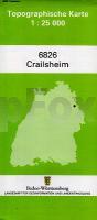
![]() | 6826 Crailsheim *** SCHNÄPPCHEN *** Topographische Landkarte 1:25.000 - Landesvermessungsamt Baden-Württemberg |
![]() | Vierlande Topographische Wanderkarte mit Wanderwegen und Radwegen 1:40.000 Schleswig-Holstein / Hamburg - ProjektNord |
![]() | 5103 Eschweiler (geplottete Ausgabe) Amtliche topographische Karte 1:25.000 Landesvermessungsamt Nordrhein-Westfalen |
![]() | Jotunheimen: Tyin & Filefjell 1:25.000 Høyfjellskart - Gebirgswanderkarte Norwegen - Calazo Förlag |
![]() | ADAC UrlaubsKarte Oberösterreich, Salzburg-Nord 1:150.000 |
![]() | Plattensee - Lake Balaton 1:80.000 - Touristische Landkarte - Radwanderkarte, Wassersportkarte - Wanderkarte Ungarn 1:50.000 Balaton - Déli-Bakony - Balaton-felvidek Szarvas Térképek - Ungarn |
![]() | 296 Lancaster - Morecambe & Fleetwood - Wanderkarte Großbritannien 1:25.000 EXPLORER MAP - Ordnance Survey |
![]() | 7029 Oettingen Bayern Topographische Landkarte Bayern 1:25.000 - Normalausgabe - ProjektNord (geplottete Ausgabe) - Grundlage amtliche Topographische Karte Bayern DTK25 |
![]() | 2236SB ST-CERE - SOUSCEYRAC-EN-QUERCY Amtliche Topographische Wanderkarte Frankreich 1:25.000 - série bleue (IGN) |
![]() | The Golden Circle Straßenkarte 1:200.000 - ferðakort Landmælingar - Island |
![]() | 045 Stonehaven & Banchory - Wanderkarte Großbritannien 1:50.000 Active Laminiert LANDRANGER MAP - Ordnance Survey |
![]() | 05 Drenthe Ost - Fahrradkarte 1:50.000 Fietskaart 05. Drenthe-Oost met Zuidoost-Groningen Falk - Niederlande |
![]() | Skitourenführer Skitouren Oberwallis Schweizer Alpen-Club |
![]() | Wadersloh Topographische Wanderkarte Nordrhein-Westfalen mit Wanderwegen und Radwegen 1:25.000 - ProjektNord |
![]() | 253T GANTRISCH - Thun - Schwarzsee - Frutigen 1:50.000 Topographische Wanderkarte SAW der Schweiz - swisstopo |
![]() | 049 Oban & East Mull - Wanderkarte Großbritannien 1:50.000 LANDRANGER MAP - Ordnance Survey |
![]() | 7735 Oberschleißheim Topographische Landkarte Bayern 1:25.000 - Normalausgabe - ProjektNord (geplottete Ausgabe) - Grundlage amtliche Topographische Karte Bayern DTK25 |
![]() | South San Juan - Del Norte - Colorado (Blatt: 142) 1:63.360 - Landkarte Trails Illustrated Map National Geographic - USA |
![]() | 467 Shetland - Mainland Central - laminierte Wanderkarte Großbritannien 1:25.000 EXPLORER MAP - Ordnance Survey |


