| << Deutschland: Karten des Deutschen Reiches 1:100.000 (Großblätter) |
  | |
|
||
Zuletzt angesehene Artikel:
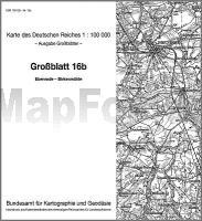
![]() | 16b Ebenrode - Birkenmühle - Karte des Deutschen Reiches 1:100.000 (KDR 100 GB) - Großblatt Reichsamt für Landesaufnahme / Preußische Landesaufnahme ProjektNord |
![]() | 2270 Pollnitz Topographische Karte 1:25.000 Messtischblatt des Deutschen Reiches - Preußische Landesaufnahme / Reichsamt für Landesaufnahme - Faksimile ProjektNord |
![]() | 766 Valdeganga Amtliche topographische Landkarte 1:50.000 Spanien (M.T.N.) 766 Mapa Topográfico Nacional de Espana (MTN50) Instituto Geográfico Nacional - CNIG Spanien |
![]() | Nordamerika politisch Antik Laminierte PLANO-Karte 1:14.009 Mio. (Format: 60 x 78 cm) - gerollt im Plastikrohr America North political antique flat map - laminated National Geographic |
![]() | 5817 Frankfurt West - Wanderkarte mit Wanderwegen (geplottete Ausgabe) Topographische Landkarte Hessen 1:25.000 - ProjektNord (geplottete Ausgabe) |
![]() | 1532 Landkirchen(Fehmarn) - Gestern und Heute - Historische Überlagerung 1878-1880 Topographische Landkarte 1:25.000 im Vergleich - Landesvermessungsamt Schleswig-Holstein / ProjektNord |
![]() | 2882 Wilhelmsdank Topographische Karte 1:25.000 Messtischblatt des Deutschen Reiches - Preußische Landesaufnahme / Reichsamt für Landesaufnahme - Faksimile ProjektNord |
![]() | 12100 Kussen Topographische Karte 1:25.000 Messtischblatt des Deutschen Reiches - Preußische Landesaufnahme / Reichsamt für Landesaufnahme - Faksimile ProjektNord |
![]() | 3662 Neutomischel Topographische Karte 1:25.000 Messtischblatt des Deutschen Reiches - Preußische Landesaufnahme / Reichsamt für Landesaufnahme - Faksimile ProjektNord |
![]() | 734 Villarta de los Montes Amtliche topographische Landkarte 1:50.000 Spanien (M.T.N.) 734 Mapa Topográfico Nacional de Espana (MTN50) Instituto Geográfico Nacional - CNIG Spanien |
![]() | 48 Finspång 1:50.000 (wasserfest) *** SCHNÄPPCHEN *** Topographische Wanderkarte - Sverigeserien Topo50 - Schweden Norstedts |
![]() | 31H UTRECHT Topographische Karte der Niederlande 1:25.000 (Plotausgabe) 31H UTRECHT Topografische Kaart van Nederland Kadaster - ProjektNord |
![]() | 0278 CANALES DE LA SIERRA Topographische Landkarte 1:50.000 Spanien (Grundlage MTN50) Instituto Geográfico Nacional - CNIG Spanien - ProjektNord |
![]() | 4915 Wingeshausen (geplottete Ausgabe) Amtliche topographische Karte 1:25.000 Landesvermessungsamt Nordrhein-Westfalen |
![]() | 2430 Gudow - Gestern und Heute - Historische Überlagerung 1932-1950 Topographische Landkarte 1:25.000 im Vergleich - Landesvermessungsamt Schleswig-Holstein / ProjektNord |
![]() | Dusetos (80-84/55-59) Topografische Karte Litauen 1:50.000 Lietuvos Respublikos Topografinis Zemelapis 1:50.000 - Nacionaline Zemes Tarnyba - Litauen |
![]() | T434 Oikarainen Topographische Karte 1:50.000 EUREF-FIN (Maastokarttat) Maanmittauslaitos / Lantmäteriverket Finnland - ProjektNord |
![]() | 4764 Parchwitz Topographische Karte 1:25.000 Messtischblatt des Deutschen Reiches - Preußische Landesaufnahme / Reichsamt für Landesaufnahme - Faksimile ProjektNord |
![]() | 97 Topographische Landkarte Wanderkarte und Fahrradkarte Portugal 1:25.000 097 Mapa topográfico - Mapa de caminhadas - Portugal 1:25.000 ProjektNord |


