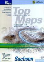
| << Deutschland: Landkarten-CDs << Deutschland: Historische Karten und Stadtpläne (im Bereich der heutigen Bundesrepublik) |
  | |
Zuletzt angesehene Artikel:
![]() | TopMaps Sachsen Historische Karten - Messtischblätter 1:25.000 letzte Ausgabe vor 1945 auf DVD - Landesvermessungsamt Sachsen |
![]() | 5621 Wenings Topographische Landkarte Hessen 1:25.000 - ProjektNord (geplottete Ausgabe) |
![]() | L7348 Wegscheid (geplottete Ausgabe) Topographische Karte Bayern 1:50.000 Bayerisches Landesvermessungsamt |
![]() | 2311-I Marstal Topographische Karte Dänemark 1:50.000 - Kort & Matrikelstyrelsen ProjektNord |
![]() | 484 Polana, Muránska planina 1:40.000 Wanderkarte Slowakei 1:40.000 - SHOCart - SHOCart |
![]() | Lohjanjärvi 1:25.000 - Kanu-Karte Lohjanjärvi - Canoeing Map Genimap - Finnland |
![]() | Dalmatinische Küste (Blatt 2) - Sibenik - Split - Vis 1:100.000 Straßenkarte mit nautischen Informationen - freytag & berndt |
![]() | 183 N Lyngen NORD 1:50.000 - Amtliche Topographische Landkarte Norwegen - Startens Kartverk |
![]() | Lago di Como, Lago di Lugano (Nr. 91) 1:50.000 - Wanderkarte mit Broschüre Wandern, Rad - GPS-genau - KOMPASS |
![]() | 203 N Vardø NORD 1:50.000 - Amtliche Topographische Landkarte Norwegen - Startens Kartverk |
![]() | 01 Sappada - San Stefano - Forni Avoltri Topographische Wanderkarte 1:25.000 - Casa Editrice Tabacco - Italien |
![]() | 135 N Træna NORD 1:50.000 - Amtliche Topographische Landkarte Norwegen - Startens Kartverk |
![]() | L-34-32-A Berettyoujfalu Amtliche Topographische Karte Ungarn 1:50.000 |
![]() | 3120SB LANGRES - AUBERIVE GPS Amtliche Topographische Wanderkarte Frankreich 1:25.000 - série bleue (IGN) |
![]() | 3506 Getelomoor Amtliche topographische Karte 1:25.000 Landesvermessungsamt Niedersachsen |
![]() | 4454 Bad Muskau Topographische Karte 1:25.000 Landesvermessungsamt Brandenburg (gefaltet) |
![]() | Costa della Maremma - Topographische Wanderkarte 1:25.000 (Blatt 529) Carta turistica e dei sentieri Edizioni Multigraphic - Italien |
![]() | Die 25 schönsten E-Bike Touren am Bodensee mit E-Bike Ladestationen - mit barrierefreien Start-/Zielbahnhöfen - mit GPS-Track-Download via website oder Kartenapp - von Steinbicker, Otmar - BVA BikeMedia |
![]() | Ohio Atlas & Gazetteer - Topographischer Straßenatlas Delorme Publishing Company DELORME MAPPING USA |
![]() | Comunita Montana - Valli del Lario e del Ceresio - Alpi Lepontine - Wanderkarte 1:25.000 Val Menaggio - Val Sanagra - Val Rezzo - Valsolda - Ingenia Editori - Italien |


