| << Finnland: Gewรคsserkarten, Wassersportkarten |
||
|
||

Zuletzt angesehene Artikel:
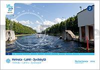
 | Heinola - Lahti - Jyvรคskylรค Gewรคsserkartenserie J - 1:40.000 Heinola - Lahti - Jyvรคskylรค Sisรคvesikarttasarja J 1:40.000 Finnland |
 | 0855 USAGRE Topographische Landkarte 1:50.000 Spanien (Grundlage MTN50) Instituto Geogrรกfico Nacional - CNIG Spanien - ProjektNord |
 | 0973 CHIRIVEL Topographische Landkarte 1:50.000 Spanien (Grundlage MTN50) Instituto Geogrรกfico Nacional - CNIG Spanien - ProjektNord |
 | NL 33-03-08 (5208) Mattersburg รsterreichische Karte 1:50.000 mit Wegmarkierungen (topographische Wanderkarte - UTM) - BEV - รsterreich |
 | 0766 VALDEGANGA Topographische Landkarte 1:50.000 Spanien (Grundlage MTN50) Instituto Geogrรกfico Nacional - CNIG Spanien - ProjektNord |
 | L4112 Warendorf (geplottete Ausgabe) Amtliche topographische Karte 1:50.000 Landesvermessungsamt Nordrhein-Westfalen |
 | 0663 VALERA DE ABAJO Topographische Landkarte 1:50.000 Spanien (Grundlage MTN50) Instituto Geogrรกfico Nacional - CNIG Spanien - ProjektNord |
 | Kempense Heuvelrug wandelnetwerk + inspiratieboekje spiral Wanderkarte 1:25.000 - Belgien Wandelnetwerk Belgien |
 | 0093-4 A SERRA DE OUTES Topographische Landkarte 1:25.000 Spanien (Grundlage MTN25) Instituto Geogrรกfico Nacional - CNIG Spanien - ProjektNord |
 | Wallonie Picarde ร pied - NL/FR/E/D rรฉseau points-noeuds Wanderungen 1:25.000 - Belgien Knooppunter - Belgien |
 | 0438 PANIZA Topographische Landkarte 1:50.000 Spanien (Grundlage MTN50) Instituto Geogrรกfico Nacional - CNIG Spanien - ProjektNord |
 | 0111-1 VILLALBA DE LOSA Topographische Landkarte 1:25.000 Spanien (Grundlage MTN25) Instituto Geogrรกfico Nacional - CNIG Spanien - ProjektNord |
 | 0330-4 CARDONA Topographische Landkarte 1:25.000 Spanien (Grundlage MTN25) Instituto Geogrรกfico Nacional - CNIG Spanien - ProjektNord |
 | T412 Aavasaksa Topographische Karte 1:50.000 EUREF-FIN (Maastokarttat) Maanmittauslaitos / Lantmรคteriverket Finnland - ProjektNord |
 | 0313-1 ANTIGรEDAD Topographische Landkarte 1:25.000 Spanien (Grundlage MTN25) Instituto Geogrรกfico Nacional - CNIG Spanien - ProjektNord |
 | 1030 TABERNAS Topographische Landkarte 1:50.000 Spanien (Grundlage MTN50) Instituto Geogrรกfico Nacional - CNIG Spanien - ProjektNord |
 | 0945-4 ALBENDรN Topographische Landkarte 1:25.000 Spanien (Grundlage MTN25) Instituto Geogrรกfico Nacional - CNIG Spanien - ProjektNord |
 | 0113-1 OZAETA Topographische Landkarte 1:25.000 Spanien (Grundlage MTN25) Instituto Geogrรกfico Nacional - CNIG Spanien - ProjektNord |
 | 0527-2 LINARES DE RIOFRรO Topographische Landkarte 1:25.000 Spanien (Grundlage MTN25) Instituto Geogrรกfico Nacional - CNIG Spanien - ProjektNord |
 | Von Paris nach Mont-Saint-Michel Radwanderfรผhrer (franzรถsisch) 10 Etappen, 3 Ausflรผge + 31 Karten - OUEST France - Frankreich De Paris au Mont-Saint-Michel ร vรฉlo |