
| << Finnland: Gewässerkarten, Wassersportkarten |
||
|
||


Zuletzt angesehene Artikel:
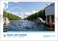
 | Heinola - Lahti - Jyväskylä Gewässerkartenserie J - 1:40.000 Heinola - Lahti - Jyväskylä Sisävesikarttasarja J 1:40.000 Finnland |
 | 6025 Arnstein Topographische Landkarte Bayern 1:25.000 (Normalausgabe - Atkis) Landesvermessungsamt Bayern |
| 5143 Chemnitz - Geologische Karte 1:25.000 (GK25 (N)) Grundlage Topographische Karte Sächsisches Landesamt für Umwelt, Landwirtschaft und Geologie |
 | M`Goun Massiv Wanderführer und Wanderkarte 1:100.000 Atlas, Central High, Mgoun Massif, map and guide WEST COL PRODUCTIONS |
| Wassersportatlas Niederlande Süd 1:50.000 Wateratlas Nederland Zuid - ANWB - Niederlande |
 | Walking the West Highland Way - 1:25.000 route map booklet Wanderkarte mit Beschreibungen - Cicerone Großbritannien (englisch) |
 | 2410 Westerholt Amtliche topographische Karte 1:25.000 Landesvermessungsamt Niedersachsen |
 | M-34-43/44 Ostrowiec Swietokrzyski Plot aus der Kartengrundlage der amtliche topographische Karte Polen 1:100.000 ProjektNord |
 | Benelux - Belgien - Niederlande - Luxemburg Straßenkarte 1:400.000 (Blatt 714) Michelin |
 | Walks around Ullswater - Haweswater, Penrith and Swindale - Wanderkarte A map-guide to 15 walks around Ullswater, in the English Lake District - Footprint Maps - Stirling Surveys |
 | Jasper National Park Straßenkarte 1:250.000 Travel Map and Guide Gem Trek |
 | 4722 Niederzwehren Topographische Landkarte Hessen 1:25.000 - ProjektNord |
 | Republik Dagestan 1:100.000 Topographischer Atlas Respublika Dagestan - Russland |
 | 7 Adelboden / Lenk Wanderkarte Schweiz 1:50.000 Hallwag |
| N-34-83-A/B Plaska Amtliche topographische Landkarte Polen 1:50.000 N-34-83-A/B Plaska - Mapa Topograficzna Polski Glowny Geodeta Kraju |
 | Hornstrandir (Blatt 9) Wanderkarte Island 1:100.000 / 1:55.000 - Sérkort - Mál og menning |
 | Parco nazionale del Gran Paradiso 1:50.000 Wanderkarte Blu Edizioni - Cartoguida 4 |
 | Internationaler Bergwanderweg Eisenach - Budapest - Fernwanderweg EB/E4: Slowakei / Ungarn von Martin Simon und Mirko Nagel |
 | Die Elbe Vom Elbsandsteingebirge bis nach Geesthacht - von Ernst P. Dörfler - TRESCHER Verlag |
 | Festung Breslau Militärhistorische Landkarte 1:20.000 Twierdza Wrocław Pracownia JB72 - Polen |