Willkommen bei MapFox
Wurde Ihre Bestellung bestätigt? Wenn nicht - gab es evtl. ein SERVER-Problem! Bitte kontaktieren Sie uns! +++ Buchhändler-Anfragen erwünscht +++
Warenkorb
Artikel: 0 - € 0.00
Zur Kasse
Impressum Kontakt Versandkosten AGB
Australia Road + 4WD - Atlas Spiral GPS HEMA Maps
<< Australien
<< HEMA Maps
 
Cover

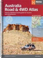
The Australia Road and 4WD Atlas is the ultimate atlas for the 4WD enthusiast. This atlas offers the same content as the Australia Road Atlas with a bonus 4WD section. The 4WD section shows off-road routes in areas including Fraser Island, Cape York and the Kimberley. This atlas now includes 24-hour fuel and caravan parks as well as rest and camping areas, overnight camps, points of interest and an extensive list of national parks with facilities.

- camping areas
- caravan parks
- roadhouses
- 4WD tracks

Kartenbeispiel

Australia Road + 4WD - Atlas Spiral GPS HEMA Maps
EAN / ISBN: 9781922668011
Preis: EUR 39.90

Bestellartikel: versandfertig in ca. 3-7 Tagen. Dieser Artikel wird speziell für Sie bestellt. Keine Rücknahme!
Produkt EUR Anzahl Bestellen
Australia Road + 4WD - Atlas Spiral GPS HEMA Maps 39.90
Versandkostenfrei in Deutschland

incl. MwSt.

Stichworte, die bei der Suche nützlich sein könnten:
Australien 4WD Atlas - Australien Straßenatlas - HEMA-Maps - Australien Landkarten - Neuseeland Landkarten - Karten aus Neuseeland - Karten aus Australien - australische Landkarten - Neuseeländische Landkarten - Australien - Downunder - Australien Landkarten - Australien Wanderkarten - Australien Trekkingkarten - Australische Landkarten - Australienkarten - Australien Reiseführer - Australien Wanderführer - Australienführer

Zuletzt angesehene Artikel:

CoverAustralia Road + 4WD - Atlas Spiral GPS HEMA Maps

CoverAustralian Slang - English Down Under (Audio-CD) Kauderwelsch AusspracheTrainer auf Audio-CD Reise-Know-How Verlag

CoverAndalusien 1:350.000 Landkarte Spanien - Reise-Know-How Verlag - world mapping project

CoverP314 Bergö Topographische Karte 1:50.000 EUREF-FIN (Maastokarttat) Maanmittauslaitos / Lantmäteriverket Finnland - ProjektNord

Cover1079_A1 ROQUE DEL ESTE Topographische Landkarte 1:50.000 Spanien (Grundlage MTN50) Instituto Geográfico Nacional - CNIG Spanien - ProjektNord

Cover44E ALMKERK Topographische Karte der Niederlande 1:25.000 (Plotausgabe)
44E ALMKERK Topografische Kaart van Nederland Kadaster - ProjektNord

Noch kein Cover vorhanden367-4 SALTO DE CASTRO Amtliche topographische Landkarte 1:25.000 Spanien (M.T.N.)
367-4 Mapa Topográfico Nacional de Espana (MTN25) Instituto Geográfico Nacional - CNIG Spanien

Cover3932 10 Stuorra-Tievja Topographische Karte 1:20.000 (Maastokartta / Peruskartta / Grundkarta) Maanmittauslaitos / Lantmäteriverket Finnland - ProjektNord

Noch kein Cover vorhandenL7314 Baden-Baden Topographische Landkarte 1:50.000 - Landesvermessungsamt Baden-Württemberg

Noch kein Cover vorhandenEL CAMINO DEL NORTE 1:75.000 Radwanderführer - PETIRROJO EDICIONES

CoverQ4411 Vatjusjärvi Topographische Karte 1:25.000 EUREF (Peruskartta) Maanmittauslaitos / Lantmäteriverket Finnland - ProjektNord

CoverL`Amblève par les GR`s 156. 72 km & 10 boucles champêtres Topo-Guide du Sentier de Grande Randonnée - Belgien (französisch) GRSentiers - Grote Routepaden

CoverL3118 Syke Amtliche topographische Karte 1:50.000 Landesvermessungsamt Niedersachsen

CoverAhlenmoor Topographische Wanderkarte mit Wanderwegen und Radwegen 1:25.000 Niedersachsen - ProjektNord

Cover320-3 TARAZONA Amtliche topographische Landkarte 1:25.000 Spanien (M.T.N.)
320-3 Mapa Topográfico Nacional de Espana (MTN25) Instituto Geográfico Nacional - CNIG Spanien

CoverLandeshaupstadt Kiel 1:25.000 *POSTER* Format 70 x 100 cm - ProjektNord

CoverAngola 1:2 Mio.- Internationale Landkarte - Cartographia

CoverLadakh und Zanskar (Süd) - Trekkingkarte 1:150.000 Editions Olizane
Upper Zanskar - Rupshu

Cover4524 03 Rukajärvi Topographische Karte 1:20.000 (Maastokartta / Peruskartta / Grundkarta) Maanmittauslaitos / Lantmäteriverket Finnland - ProjektNord

CoverChile & Argentinien mit Osterinsel - Straßenatlas 1:1.25 Mio. / 1:2.2 Mio / 1:38.000 / 1:750.000 - ITMB International Travel Atlas (engl.)
Chile and Argentina including Easter Island