| << Spanien: Wanderkarten - ICGC (ICC) - Institut Cartogrà fic i Geològic de Catalunya |
||
|
||

Zuletzt angesehene Artikel:
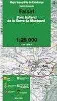
 | Falset (Blatt 09) 1:25.000 Parc Natural de la Serra de Montsant - Wanderkarte Katalonien (Spanien) - Col·lecció Capitals Comarcals - Institut Cartogrà fic de Catalunya |
 | 201 Erzgebirge Touristische Landkarte Tschechien 1:100.000 Krusné hory - SHOCart |
 | Müritz-Nationalpark, Waren - Röbel - Mirow - Neustrelitz Rad- und Wanderkarte mit Ausflugszielen, Einkehr- & Freizeittipps, Nebenkarte Müritz Nationalpark, östlicher Teil, StraÃennamen, wetterfest, reissfest, abwischbar, GPS-genau. 1:50000 - von - Freytag-Berndt und ARTARIA Publicpress |
 | 364.1 Amtliche topographische Karte 1:50.000 Polen |
 | Krakau-Tschenstochauer Jura 1:50.000 Wasserfeste touristische Landkarte Jura Krakowsko-Częstochowska - mapa turystyczna Compass - Polen |
 | CC 2310 Helgoland Geologische Ãbersichtskarte 1:200.000 - Bundesanstalt für Geowissenschaften und Rohstoffe (BGR) |
 | Monte Genzana - Monte Rotella - Montagne del Centro Abruzzo (Blatt 9) Wanderkarte 1:25.000 Edizioni Il Lupo - Club Alpino Italiano (CAI) |
 | Radregion Dänemark Ost - Auf den Inseln Sjælland, Lolland, Falster und Møn Radatlas bikeline - Esterbauer |
 | Fietsnetwerk Kempen - fietsknooppuntenkaart Fahrradkarte 1:65.000 - Belgien Knooppunter - Belgien Fietsnetwerk KEMPEN - Provincie Antwerpen |
| 5259 Schneegruben-Baude Topographische Karte 1:25.000 Messtischblatt des Deutschen Reiches - PreuÃische Landesaufnahme / Reichsamt für Landesaufnahme - Faksimile ProjektNord |
 | N-33-65/66 Swinoujscie (Swinemünde) Nord Plot aus der Kartengrundlage der amtliche topographische Karte Polen 1:100.000 ProjektNord |
| 8221 Ãberlingen Ost Topographische Landkarte 1:25.000 - Landesvermessungsamt Baden-Württemberg |
 | 4041 Straach Topographische Karte 1:25.000 Landesvermessungsamt Brandenburg (gefaltet) |
 | Patagonien Süd und Feuerland - StraÃenkarte 1:1 Mio. Argentinien / Chile Patagonia Sur & Tierra del Fuego ZAGIER & URRUTY PUBLICATIONS |
 | Nördlicher Bayerischer Wald 1:50.000 - Wanderkarte mit Broschüre (Blatt 195) KOMPASS |
| 349 Lourinhã- Topographische Landkarte Portugal 1:25.000 Carta Militar de Portugal - Série M889 Instituto Geográfico do Exército (IGeoE) - Portugal |
 | 612 Hvannasund Färöer - Topographische Karte 1:20.000 612 Færøer - Topografisk kort 1:20.000 - Miliøministeriet - Kort & Matrikelstyrelsen / ProjektNord |
 | Pfälzerwald 1 - Eisenberg Topographische Wanderkarte Rheinland-Pfalz mit Wanderwegen und Radwegen 1:25.000 - ProjektNord |
| 155.4 Amtliche topographische Karte 1:50.000 Polen |
 | Harzrundweg - Radwanderführer mit 23 Detailkarten 1:50.000 KKV - Kartographische Kommunale Verlagsgesellschaft |