| << Spanien: Wanderkarten - ICGC (ICC) - Institut Cartogrà fic i Geològic de Catalunya |
  | |
|
||
Zuletzt angesehene Artikel:
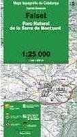
![]() | Falset (Blatt 09) 1:25.000 Parc Natural de la Serra de Montsant - Wanderkarte Katalonien (Spanien) - Col·lecció Capitals Comarcals - Institut Cartogrà fic de Catalunya |
![]() | R5424 Martinselkonen Topographische Karte 1:25.000 EUREF (Peruskartta) Maanmittauslaitos / Lantmäteriverket Finnland - ProjektNord |
![]() | MORZINE & PORTES DU SOLEIL - Bikefax Mountain Bike Guide Morzine and Portes Du Soleil Selected Downhill and Cross Country Mountain Bike Trails BIKEFAX Mountain Bike Guides |
![]() | Region Müllerthal - Kleine Luxemburger Schweiz - Wanderkarte 1:25.000 mit Wanderwegen - Wanderkarte Luxemburg |
![]() | NS531 Simikot to Humla 1:150.000 - Limi Valley - Nying Valley - Saipal Himal BC - Rara - Limi Lapcha La - Trekkingkarte - Himalayan MapHouse - Nepal |
![]() | 1366 MONT VELAN 1:25.000 *** SCHNÄPPCHEN *** Topographische Landeskarte der Schweiz - swisstopo |
![]() | 2918SB Bar-sur-Seine - Loches-sur-Ource GPS Amtliche Topographische Wanderkarte Frankreich 1:25.000 - série bleue (IGN) |
![]() | Osterode in Ostpreußen Kreiskarte des Deutschen Reiches 1:100.000 (KDR 100 KK) - Faksimile Reichsamt für Landesaufnahme |
![]() | Inglefield Land (Blatt 4) 1:500.000 Topographische Landkarte Nord-Grönland Kort & Matrikelstyrelsen Dänemark |
![]() | 0750-1 RISCOS DE HIGÜELA Topographische Landkarte 1:25.000 Spanien (Grundlage MTN25) Instituto Geográfico Nacional - CNIG Spanien - ProjektNord |
![]() | 2720 Tarmstedt Topographische Wanderkarte 1:25.000 Niedersachsen mit Wanderwegen - ProjektNord |
![]() | N-34-49/50 Gdansk (Danzig) Plot aus der Kartengrundlage der amtliche topographische Karte Polen 1:100.000 ProjektNord |
![]() | Hasi Präfektur-Landkarte Albanien 1:70.000 GPS (Blatt 361) wasserfest Vektor Editions - Albanien |
![]() | 2042SB Grenade - Verdun-sur-Garonne - GPS Amtliche Topographische Wanderkarte Frankreich 1:25.000 - série bleue (IGN) |
![]() | Te Araroa - A Walking Guide to New Zealand`s Long Trail 113 Walks from Cape Reinga to Bluff - including Day Walks & Long Tramps - by Geoff Chapple - Randomhouse Neuseeland |
![]() | 3117 Twistringen Topographische Wanderkarte 1:25.000 Niedersachsen mit Wanderwegen - ProjektNord |
![]() | 2423SB Les Aix-d´Angillon / Sancerre GPS Amtliche Topographische Wanderkarte Frankreich 1:25.000 - série bleue (IGN) |
![]() | C8 Billefjorden Spitzbergen / Svalbard / Spitsbergen - Topographische Karte 1:100.000 Norsk Polarinstitutt |
![]() | 428 Kyle of Lochalsh - laminierte Wanderkarte Großbritannien 1:25.000 EXPLORER MAP - Ordnance Survey |
![]() | 040 Mallaig & Glenfinnan - Loch Shiel - Wanderkarte Großbritannien 1:50.000 LANDRANGER MAP - Ordnance Survey |


