| << Spanien: Wanderkarten - ICGC (ICC) - Institut Cartogràfic i Geològic de Catalunya |
  | |
|
||
Zuletzt angesehene Artikel:
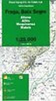
![]() | Fraga, Baix Segre (Blatt 73) 1:25.000 Aitona, Alfés, Mequinensa, Maials - Wanderkarte Katalonien (Spanien) - Col·lecció Unitats Geogràfiques - Institut Cartogràfic de Catalunya |
![]() | Peak District Great Short Walks for all the family - Pathfinder 2 - Englischsprachiger Wanderführer Jarrold Crimson Publishing |
![]() | C8334 Bad Tölz Topographische Karte 1:100.000 - ProjektNord - Kartographie Bayrisches Landesvermessungsamt |
![]() | Vorarlberg Mit Bregenzer Wald, Großem Walsertal, Arlberg und Montafon - von Gunnar Strunz Trescher Verlag |
![]() | W252 Sigmaringen - Wanderkarte 1:25.000 - Obere Donau (Ost) - Zwiefalten - Schwäbischer Albverein |
![]() | 132 Böhmerwald - Klattau - Fahrradkarte Tschechien 1:70.000 Sumava - Klatovsko - cykloturistická mapa KARTOGRAFIE PRAHA |
![]() | 3815SB Bischwiller - Brumat Amtliche Topographische Wanderkarte Frankreich 1:25.000 - série bleue (IGN) |
![]() | Le Pays de la Chaise-Dieu... à pied - Réf. P43C Topographischer Wanderführer - FFRP (Fédération française de randonnée pédestre) Frankreich |
![]() | El Hierro - Mapa Turistico / Touristische Karte / Tourist Map - Wanderrouten 1:50.000 von José Manuel Moreno - Turquesa Publicaciones |
![]() | 2844 Fürstenberg / Havel Sonderausgabe mit Wanderwegen - Topographische Wanderkarte Brandenburg 1:25.000 ProjektNord |
![]() | 2728 Lüneburg Amtliche topographische Karte 1:25.000 Landesvermessungsamt Niedersachsen |
![]() | 3515 Hunteburg Amtliche topographische Karte 1:25.000 Landesvermessungsamt Niedersachsen |
![]() | Pfälzerwald 10 - Annweiler am Trifels Topographische Wanderkarte Rheinland-Pfalz mit Wanderwegen und Radwegen 1:25.000 - ProjektNord |
![]() | Karte der Balkan-Halbinsel - Historische Karte um 1910 (Reprint PLANO) - von Handtke, Friedrich (Kartograf) - Verlag Rockstuhl |
![]() | 036 Grantown & Aviemore - Cairngorm Mountains - Wanderkarte Großbritannien 1:50.000 LANDRANGER MAP - Ordnance Survey |
![]() | 14 Breidafjördur Topographische Karte Island 1:100.000 - Ferdakort 14 BREIÐAFJÖRÐUR - Atlaskort - Ferðakort |
![]() | 2041SB Montauban - Castelsarrasin GPS Amtliche Topographische Wanderkarte Frankreich 1:25.000 - série bleue (IGN) |
![]() | Kampanien Straßenkarte 1:250.000 Straßenkarte Campania Carta stradale L.A.C. GlobalMap Italien |
![]() | Fahrradkarte Berlin Nord 1:60.000 wasserfest - reißfest- Grünes Herz |
![]() | Schusteracht - Preetz Topographische Wanderkarte mit Wanderwegen und Radwegen 1:25.000 Schleswig-Holstein - ProjektNord |


