| << Portugal: Amtliche topografische Landkarten des Instituto Geográfico do Exército (IGeoE) 1:25.000 (Serie M888) |
||
|
||

Zuletzt angesehene Artikel:
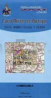
 | 7 - Topographische Landkarte Portugal 1:25.000 Carta Militar de Portugal - Série M888 Instituto Geográfico do Exército (IGeoE) - Portugal |
 | 4918 Frankenberg - Wanderkarte mit Wanderwegen (geplottete Ausgabe) Topographische Landkarte Hessen 1:25.000 - ProjektNord (geplottete Ausgabe) |
 | 357-3 SENA Amtliche topographische Landkarte 1:25.000 Spanien (M.T.N.) 357-3 Mapa Topográfico Nacional de Espana (MTN25) Instituto Geográfico Nacional - CNIG Spanien |
 | V4413 Topographische Karte 1:25.000 EUREF (Peruskartta) Maanmittauslaitos / Lantmäteriverket Finnland - ProjektNord |
 | 2209SB Poix-de-Picardie - Hornoy-le-Bourg Amtliche Topographische Wanderkarte Frankreich 1:25.000 - série bleue (IGN) |
| 9 I - Guimarães - Topographische Landkarte Portugal 1:50.000 Carta Militar de Portugal Instituto Geográfico do Exército (IGeoE) - Portugal |
 | 0299-3 SALCIDOS Topographische Landkarte 1:25.000 Spanien (Grundlage MTN25) Instituto Geográfico Nacional - CNIG Spanien - ProjektNord |
 | Altmarkrundkurs - 1:50.000 - Bikeline Radtourenbuch kompakt - Durch ursprüngliche Landschaften und historische Hansestädte der Altmark - Wetterfest, reiÃfest - Esterbauer |
 | 0409 CALATAYUD Topographische Landkarte 1:50.000 Spanien (Grundlage MTN50) Instituto Geográfico Nacional - CNIG Spanien - ProjektNord |
 | 11-114 Aš Topographische Karte 1:25.000 der Tschechischen Republik Zakladnà mapa Ceská republika - Cesky urad zememericky a katastralni - ProjektNord |
 | 0279 VILLOSLADA DE CAMEROS Topographische Landkarte 1:50.000 Spanien (Grundlage MTN50) Instituto Geográfico Nacional - CNIG Spanien - ProjektNord |