| << Portugal: Amtliche topografische Landkarten des Instituto Geográfico do Exército (IGeoE) 1:25.000 (Serie M888) |
||
|
||

Zuletzt angesehene Artikel:
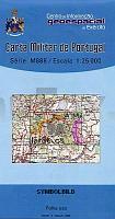
 | 9-A - Topographische Landkarte Portugal 1:25.000 Carta Militar de Portugal - Série M888 Instituto Geográfico do Exército (IGeoE) - Portugal |
 | Frankreich 1:250.000 (aktuelle Jahresausgabe) Touristischer StraÃenatlas A4 France atlas routier et touristique Michelin Frankreich |
 | 2214 11 Siekkiskylä Topographische Karte 1:20.000 (Maastokartta / Peruskartta / Grundkarta) Maanmittauslaitos / Lantmäteriverket Finnland - ProjektNord |
 | 3413 09 Kuurajärvi Topographische Karte 1:20.000 (Maastokartta / Peruskartta / Grundkarta) Maanmittauslaitos / Lantmäteriverket Finnland - ProjektNord |
 | 828-4 FERIA Amtliche topographische Landkarte 1:25.000 Spanien (M.T.N.) 828-4 Mapa Topográfico Nacional de Espana (MTN25) Instituto Geográfico Nacional - CNIG Spanien |
 | Kroatien, Slowenien und Bosnien-Herzegowina StraÃenkarte 1:800.000 Croazia - Slovenia - Bosnia Herzegovina L.A.C. GlobalMap Italien |
 | 3742 08 Suku-Nattanen Topographische Karte 1:20.000 (Maastokartta / Peruskartta / Grundkarta) Maanmittauslaitos / Lantmäteriverket Finnland - ProjektNord |
 | 1023 09 Porsskär Topographische Karte 1:20.000 (Maastokartta / Peruskartta / Grundkarta) Maanmittauslaitos / Lantmäteriverket Finnland - ProjektNord |
 | 3332 08 Mäntylahti Topographische Karte 1:20.000 (Maastokartta / Peruskartta / Grundkarta) Maanmittauslaitos / Lantmäteriverket Finnland - ProjektNord |
 | 23-4 LANZÃS Amtliche topographische Landkarte 1:25.000 Spanien (M.T.N.) 23-4 Mapa Topográfico Nacional de Espana (MTN25) Instituto Geográfico Nacional - CNIG Spanien |
 | 525-3 ESPEJA Amtliche topographische Landkarte 1:25.000 Spanien (M.T.N.) 525-3 Mapa Topográfico Nacional de Espana (MTN25) Instituto Geográfico Nacional - CNIG Spanien |
 | Pieninen Touristische Landkarte 1:25.000 (laminierte Ausgabe) Wassersportkarte, Wanderkarte Pieniny mapa (lamin.) PLAN Galileos - Polen |
 | 44 Ortelsburg - Neidenburg - Karte des Deutschen Reiches 1:100.000 (KDR 100 GB) - GroÃblatt Reichsamt für Landesaufnahme / PreuÃische Landesaufnahme ProjektNord |
 | 38-3 MUNGIA Amtliche topographische Landkarte 1:25.000 Spanien (M.T.N.) 38-3 Mapa Topográfico Nacional de Espana (MTN25) Instituto Geográfico Nacional - CNIG Spanien |
 | 663-1 VALERA DE ABAJO Amtliche topographische Landkarte 1:25.000 Spanien (M.T.N.) 663-1 Mapa Topográfico Nacional de Espana (MTN25) Instituto Geográfico Nacional - CNIG Spanien |
 | 2213 01 Latovesi Topographische Karte 1:20.000 (Maastokartta / Peruskartta / Grundkarta) Maanmittauslaitos / Lantmäteriverket Finnland - ProjektNord |
 | 527-4 VALERO Amtliche topographische Landkarte 1:25.000 Spanien (M.T.N.) 527-4 Mapa Topográfico Nacional de Espana (MTN25) Instituto Geográfico Nacional - CNIG Spanien |
 | 1088-II (Tenerife) Tegueste Amtliche topographische Landkarte 1:25.000 Spanien (M.T.N.) 1088-II Mapa Topográfico Nacional de Espana (MTN25) Instituto Geográfico Nacional - CNIG Spanien |
 | 3041 09 Kuorsalo Topographische Karte 1:20.000 (Maastokartta / Peruskartta / Grundkarta) Maanmittauslaitos / Lantmäteriverket Finnland - ProjektNord |
 | 4709 Wuppertal-Barmen - Wanderkarte mit Wanderwegen (geplottete Ausgabe) ProjektNord - Grundlage Amtliche topographische Karte 1:25.000 Landesvermessungsamt Nordrhein-Westfalen |