| << Portugal: Amtliche topografische Landkarten des Instituto Geográfico do Exército (IGeoE) 1:25.000 (Serie M888) |
||
|
||

Zuletzt angesehene Artikel:
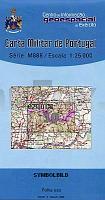
 | 10 - Topographische Landkarte Portugal 1:25.000 Carta Militar de Portugal - Série M888 Instituto Geográfico do Exército (IGeoE) - Portugal |
 | L3306 Emlichheim (geplottete Ausgabe) Topographische Karte 1:50.000 Kartografie Landesvermessungsamt Niedersachsen - ProjektNord |
 | L4434 Myllykoski Topographische Karte 1:25.000 EUREF (Peruskartta) Maanmittauslaitos / Lantmäteriverket Finnland - ProjektNord |
 | 0442 CASPE Topographische Landkarte 1:50.000 Spanien (Grundlage MTN50) Instituto Geográfico Nacional - CNIG Spanien - ProjektNord |
 | 0353 PEDROLA Topographische Landkarte 1:50.000 Spanien (Grundlage MTN50) Instituto Geográfico Nacional - CNIG Spanien - ProjektNord |
 | Oberschwaben Nord (Nr. 782) 1:50.000 - Wanderkarte mit Broschüre Bad Buchau - Bad Schussenried - Bad Waldsee - Bad Wurzach - Biberach a. d. Rià - Laupheim KOMPASS |
 | 252 Topographische Landkarte Wanderkarte und Fahrradkarte Portugal 1:25.000 252 Mapa topográfico - Mapa de caminhadas - Portugal 1:25.000 ProjektNord |
 | 0113 AGURAIN/SALVATIERRA Topographische Landkarte 1:50.000 Spanien (Grundlage MTN50) Instituto Geográfico Nacional - CNIG Spanien - ProjektNord |
 | Parc Marais Cotentin - Bessin... à pied - promenades & randonnées - Réf. PN20 Topographischer Wanderführer - FFRP (Fédération française de randonnée pédestre) Frankreich |