
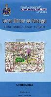
| << Portugal: Amtliche topografische Landkarten des Instituto Geográfico do Exército (IGeoE) 1:25.000 (Serie M888) |
||
|
||


Zuletzt angesehene Artikel:
 | 34 - Topographische Landkarte Portugal 1:25.000 Carta Militar de Portugal - Série M888 Instituto Geográfico do Exército (IGeoE) - Portugal |
 | S4423 Tainijoki Topographische Karte 1:25.000 EUREF (Peruskartta) Maanmittauslaitos / Lantmäteriverket Finnland - ProjektNord |
 | 0759 PIEDRABUENA Topographische Landkarte 1:50.000 Spanien (Grundlage MTN50) Instituto Geográfico Nacional - CNIG Spanien - ProjektNord |
 | 0286-4 NOVALES Topographische Landkarte 1:25.000 Spanien (Grundlage MTN25) Instituto Geográfico Nacional - CNIG Spanien - ProjektNord |
 | Ouest des Vosges 881 GR + 10 jourd de randonnée - Réf. 0881 Topographischer Wanderführer - FFRP (Fédération française de randonnée pédestre) Frankreich |
 | Sentier vers Saint-Jacques-de-Compostelle - Genève-Le Puy GR65 (Jakobsweg) *** SCHNÄPPCHEN *** - Réf. 0650 Topographischer Wanderführer - FFRP (Fédération française de randonnée pédestre) Frankreich |
 | 21-23, 21-14 Domazlice Topographische Karte 1:50.000 der Tschechischen Republik Zakladní mapa Ceská republika - Cesky urad zememericky a katastralni - ProjektNord |
 | 0411-4 FUENDETODOS Topographische Landkarte 1:25.000 Spanien (Grundlage MTN25) Instituto Geográfico Nacional - CNIG Spanien - ProjektNord |
 | 0368-2 CARBAJALES DE ALBA Topographische Landkarte 1:25.000 Spanien (Grundlage MTN25) Instituto Geográfico Nacional - CNIG Spanien - ProjektNord |
 | L3341 Sauvo Topographische Karte 1:25.000 EUREF (Peruskartta) Maanmittauslaitos / Lantmäteriverket Finnland - ProjektNord |
 | 0047-4 COSPEITO Topographische Landkarte 1:25.000 Spanien (Grundlage MTN25) Instituto Geográfico Nacional - CNIG Spanien - ProjektNord |
 | M3423 Lassila Topographische Karte 1:25.000 EUREF (Peruskartta) Maanmittauslaitos / Lantmäteriverket Finnland - ProjektNord |
 | 0400-1 VALDESTILLAS Topographische Landkarte 1:25.000 Spanien (Grundlage MTN25) Instituto Geográfico Nacional - CNIG Spanien - ProjektNord |
 | 12-23 Kladno Topographische Karte 1:50.000 der Tschechischen Republik Zakladní mapa Ceská republika - Cesky urad zememericky a katastralni - ProjektNord |
 | 0025-3 TARAMUNDI Topographische Landkarte 1:25.000 Spanien (Grundlage MTN25) Instituto Geográfico Nacional - CNIG Spanien - ProjektNord |
 | 2209SB Poix-de-Picardie - Hornoy-le-Bourg Amtliche Topographische Wanderkarte Frankreich 1:25.000 - série bleue (IGN) |
 | Vall de la Llosa, el Baridà (Blatt 55) 1:25.000 Andorra la Vella, Tossa Plana de Lles, Puigpedrós, la Batllia - Wanderkarte Katalonien (Spanien) - Col·lecció Unitats Geogràfiques - Institut Cartogràfic de Catalunya |
 | 38O GORINCHEM (Oost) Topographische Karte der Niederlande 1:50.000 Topografische Dienst (Plotausgabe) |
 | S5411 Poussu Topographische Karte 1:25.000 EUREF (Peruskartta) Maanmittauslaitos / Lantmäteriverket Finnland - ProjektNord |
 | 0440-2 VINACEITE Topographische Landkarte 1:25.000 Spanien (Grundlage MTN25) Instituto Geográfico Nacional - CNIG Spanien - ProjektNord |