| << Portugal: Amtliche topografische Landkarten des Instituto Geográfico do Exército (IGeoE) 1:25.000 (Serie M888) |
||
|
||

Zuletzt angesehene Artikel:
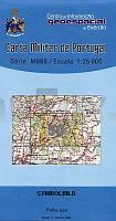
 | 50 - Topographische Landkarte Portugal 1:25.000 Carta Militar de Portugal - Série M888 Instituto Geográfico do Exército (IGeoE) - Portugal |
 | Tour de la Vallée d`Ossau - Topocarte 1:25.000 - Réf. TC641 Topographische Wanderkarte - FFRP (Fédération française de randonnée pédestre) Frankreich |
 | Pokutsko-Bukovyna Carpathians 1:50.000 Topographische Wanderkarte 1:50.000 Karpaten - Ukraine (Laminierte Ausgabe) Pokutsko-Bukovyna Carpathians Karpatski Steszky Hutyriak - laminovana karta Ukraine |
 | Mani (Blatt 8.4) Topografische Bergwanderkarte Griechenland 1:30.000- Peloponnese - Anavasi - Griechenland Mani - Manh - Μανη - ΠΕΡΙΗΓΗΤΙΚΟΣ & ΠΕΖΟΠΟΡΙΚΟΣ ΧΑΡΤΗΣ - Touring & Hiking Map |
 | Rapid City / Black Hills / Spearfish / Badlands Natl Park Stadtplan 1:36.000 (South Dakota - USA) Rapid City / Black Hills / Spearfish / Badlands Natl Park street map Universal Map Group (Kappa) / GM Johnson |
 | 13 Selenge Aimag 1:500.000 Touristische Landkarte Selenge Aymag - Сэлэнгэ Аймаг - газрын зураг - Монсудар Monsudar - Mongolei |
 | 796-4 DÃNIA Amtliche topographische Landkarte 1:25.000 Spanien (M.T.N.) 796-4 Mapa Topográfico Nacional de Espana (MTN25) Instituto Geográfico Nacional - CNIG Spanien |
 | 6640 Neunburg vorm Wald Topographische Landkarte Bayern 1:25.000 - Normalausgabe - ProjektNord (geplottete Ausgabe) - Grundlage amtliche Topographische Karte Bayern DTK25 |
 | 7037 Kelheim Topographische Landkarte Bayern 1:25.000 - Normalausgabe - ProjektNord (geplottete Ausgabe) - Grundlage amtliche Topographische Karte Bayern DTK25 |
 | 255-1 BAGà Amtliche topographische Landkarte 1:25.000 Spanien (M.T.N.) 255-1 Mapa Topográfico Nacional de Espana (MTN25) Instituto Geográfico Nacional - CNIG Spanien |
 | Südtirol, Trentino, Gardasee, Venetien - Sud Tirol, Trentin, Lac de Garde, Venetie 1:200.000 Auto- + Freizeitkarte Alto Adige, Trentino, Lago di Garda, Veneto - Tirol del Sur, Trentino, Lago del Garda freytag & berndt |
 | UK 50-4 Naturpark Frankenwald West - Kronach, Kulmbach, Ludwigsstadt, Naila *** SCHNÃPPCHEN *** Wanderkarte Bayern 1:50.000 mit Wanderwegen und Radwanderwegen, GPS-Gitter - Landesamt für Digitalisierung, Breitband und Vermessung (Landesvermessungsamt Bayern) |
 | Waldenburger Bergland und Steinberge 1:35 000 Touristische Wanderkarte Polen Góry Wałbrzyskie i Kamienne, 1:35 000 (wyd. pap.) Compass - Polen |
 | 650-1 CAÃAVERAL Amtliche topographische Landkarte 1:25.000 Spanien (M.T.N.) 650-1 Mapa Topográfico Nacional de Espana (MTN25) Instituto Geográfico Nacional - CNIG Spanien |
 | 5628 Bad Königshofen Topographische Landkarte Bayern 1:25.000 - Normalausgabe - ProjektNord (geplottete Ausgabe) - Grundlage amtliche Topographische Karte Bayern DTK25 |
 | Die Ostseeküste - touristische Landkarte 1:190.000 Touristische Landkarte - Polen Wybrzeże Bałtyku- Aktywnie nad morzem PLAN Galileos - Polen |
 | 342 Villabrágima Amtliche topographische Landkarte 1:50.000 Spanien (M.T.N.) 342 Mapa Topográfico Nacional de Espana (MTN50) Instituto Geográfico Nacional - CNIG Spanien |
 | Breidsundet - Fjørtoft - Seekarte Norwegische Küste 1:50.000 - (Blatt 31) Den Norske Kyst Sjøkart - Hovedkart (sjø) Statens Kartverk Sjø - Norwegen |
 | 128 Joao da Pesqueira - Topographische Landkarte Portugal 1:25.000 Carta Militar de Portugal - Série M888 Instituto Geográfico do Exército (IGeoE) - Portugal |
 | 34-36 Povoacao (S. Miguel - Azoren) Topografische Karte Portugal 1:25.000 Carta Militar de Portugal - Série M889 - 1/25 000 (Acores) - Instituto Geográfico do Exército (IGeoE) - Portugal |