
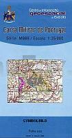
| << Portugal: Amtliche topografische Landkarten des Instituto Geográfico do Exército (IGeoE) 1:25.000 (Serie M888) |
||
|
||


Zuletzt angesehene Artikel:
 | 67-A - Topographische Landkarte Portugal 1:25.000 Carta Militar de Portugal - Série M888 Instituto Geográfico do Exército (IGeoE) - Portugal |
 | Le Vie del Sale (Blatt 3) - Torriglia e le Valli Scrivia, Trebbia e Aveto - Wanderkarte Italien 1:25.000 dall´Oltrepo Parvese al Mare - Topographische Wanderkarte Studio Cartografico Italiano - Italien |
 | 0158-4 PONFERRADA Topographische Landkarte 1:25.000 Spanien (Grundlage MTN25) Instituto Geográfico Nacional - CNIG Spanien - ProjektNord |
 | 0644-4 POLLENÇA Topographische Landkarte 1:25.000 Spanien (Grundlage MTN25) Instituto Geográfico Nacional - CNIG Spanien - ProjektNord |
 | 0519 AGUAVIVA Topographische Landkarte 1:50.000 Spanien (Grundlage MTN50) Instituto Geográfico Nacional - CNIG Spanien - ProjektNord |
 | Kieler Wanderatlas Allerfeinste Touren rund um Kiel - 40 erprobte Touren - Gratis GPS-Tracks - Exakte Karten - Detailliertes Wegenetz - Anbindung an den ÖPNV - von Jens Uwe Mollenhauer - ProjektNord |
 | 0533-2 COLLADO VILLALBA Topographische Landkarte 1:25.000 Spanien (Grundlage MTN25) Instituto Geográfico Nacional - CNIG Spanien - ProjektNord |
 | 0533-3 EL ESCORIAL Topographische Landkarte 1:25.000 Spanien (Grundlage MTN25) Instituto Geográfico Nacional - CNIG Spanien - ProjektNord |
 | Valsesia 1:25.000 - Winterwanderkarte (wasserfest) Val Vogna - Val Sorba - Alpe di Mera - Topographische Wanderkarte (dt./engl./ital.) Valsesia - Percorsi invernale Geo4 Map - Italien |
 | Q4442 Kestilä Topographische Karte 1:25.000 EUREF (Peruskartta) Maanmittauslaitos / Lantmäteriverket Finnland - ProjektNord |
 | La Habana Vieja Mapa turistico, Tourist map, Touristische Karte, Carte touristique, Mappa turistica - Huber Kartographie |
 | L5214 Suur-Miehikkälä Topographische Karte 1:25.000 EUREF (Peruskartta) Maanmittauslaitos / Lantmäteriverket Finnland - ProjektNord |
 | 48D HOOFDPLAAT Topographische Karte der Niederlande 1:25.000 (Plotausgabe) 48D HOOFDPLAAT Topografische Kaart van Nederland Kadaster - ProjektNord |
 | 26 III Peniche Topographische Landkarte Portugal 1:50.000 Carta Militar de Portugal Instituto Geográfico do Exército (IGeoE) - Portugal |
 | 0185-2 PONTEVEDRA Topographische Landkarte 1:25.000 Spanien (Grundlage MTN25) Instituto Geográfico Nacional - CNIG Spanien - ProjektNord |
 | 0414-3 MASES DE LA BALSA Topographische Landkarte 1:25.000 Spanien (Grundlage MTN25) Instituto Geográfico Nacional - CNIG Spanien - ProjektNord |
 | 0250-2 PERARRÚA Topographische Landkarte 1:25.000 Spanien (Grundlage MTN25) Instituto Geográfico Nacional - CNIG Spanien - ProjektNord |
 | 0179-1 BIELSA Topographische Landkarte 1:25.000 Spanien (Grundlage MTN25) Instituto Geográfico Nacional - CNIG Spanien - ProjektNord |
 | 0243-3 ARNEDO Topographische Landkarte 1:25.000 Spanien (Grundlage MTN25) Instituto Geográfico Nacional - CNIG Spanien - ProjektNord |
 | 0547-3 ALCANAR Topographische Landkarte 1:25.000 Spanien (Grundlage MTN25) Instituto Geográfico Nacional - CNIG Spanien - ProjektNord |