
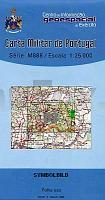
| << Portugal: Amtliche topografische Landkarten des Instituto Geográfico do Exército (IGeoE) 1:25.000 (Serie M888) |
||
|
||


Zuletzt angesehene Artikel:
 | 83 Vila Nova de Famalicao - Topographische Landkarte Portugal 1:25.000 Carta Militar de Portugal - Série M888 Instituto Geográfico do Exército (IGeoE) - Portugal |
 | Großbritannien 1:800.000 *** SCHNÄPPCHEN *** Straßenkarte Borch laminiert Great Britain |
 | 5640 Klingenthal/Sa. Amtliche Topographische Landkarte 1:25.000 (Präsentationsgrafik) - Landesvermessungsamt Sachsen |
 | 0248-3 APIÉS Topographische Landkarte 1:25.000 Spanien (Grundlage MTN25) Instituto Geográfico Nacional - CNIG Spanien - ProjektNord |
 | 2411-I Sakskøbing - mit Wanderwegen und Fahrradrouten Topographische Fahrradkarte und Wanderkarte Dänemark 1:50.000 - Kort & Matrikelstyrelsen ProjektNord 2411-I Sakskøbing - Topografisk Cykel- og Vandrekort Danmark |
 | U4414 Tepsa Topographische Karte 1:25.000 EUREF (Peruskartta) Maanmittauslaitos / Lantmäteriverket Finnland - ProjektNord |
 | 153 - Topographische Landkarte Portugal 1:25.000 Carta Militar de Portugal - Série M888 Instituto Geográfico do Exército (IGeoE) - Portugal |
 | Bijsk Stadtplan 1:25.000 - Russland Biysk |
 | 374 - Topographische Landkarte Portugal 1:25.000 Carta Militar de Portugal - Série M888 Instituto Geográfico do Exército (IGeoE) - Portugal |
 | 2748 Haßleben Sonderausgabe mit Wanderwegen - Topographische Wanderkarte Brandenburg 1:25.000 ProjektNord |
| 3540-SO Topographische Karte 1:10.000 - Landesvermessungsamt Brandenburg |
 | 2101 (NL 32-06-01) Gaschurn Topographische Wanderkarte 1:50.000 mit Wegmarkierungen - Österreich - Kartographie BEV - ProjektNord |
 | Q5242 Kontiomäki Topographische Karte 1:25.000 EUREF (Peruskartta) Maanmittauslaitos / Lantmäteriverket Finnland - ProjektNord |
 | 3946 Baruth/Mark - Paplitz Sonderausgabe mit Wanderwegen - Topographische Wanderkarte Brandenburg 1:25.000 ProjektNord |
 | 575 Alcoutim - Topographische Landkarte Portugal 1:25.000 Carta Militar de Portugal - Série M888 Instituto Geográfico do Exército (IGeoE) - Portugal |
 | 2411-III - mit Wanderwegen und Fahrradrouten Topographische Fahrradkarte und Wanderkarte Dänemark 1:50.000 - Kort & Matrikelstyrelsen ProjektNord 2411-III - Topografisk Cykel- og Vandrekort Danmark |
 | 5704 Prüm - Wanderkarte mit Wanderwegen (geplottete Ausgabe) ProjektNord - Grundlage Amtliche topographische Karte Landesamt für Vermessung und Geobasisinformation Rheinland-Pfalz |
 | 2747 Boitzenburg Sonderausgabe mit Wanderwegen - Topographische Wanderkarte Brandenburg 1:25.000 ProjektNord |
| NJ 35-3 Balikesir Amtliche Topographische Karte der Türkei 1:250.000 NJ 35-3 Balikesir - Müşterek Harekat Haritası HGK |
 | L2514 Wilhelmshaven (geplottete Ausgabe) Topographische Karte 1:50.000 Kartografie Landesvermessungsamt Niedersachsen - ProjektNord |