
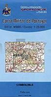
| << Portugal: Amtliche topografische Landkarten des Instituto Geográfico do Exército (IGeoE) 1:25.000 (Serie M888) |
||
|
||


Zuletzt angesehene Artikel:
 | 93 - Topographische Landkarte Portugal 1:25.000 Carta Militar de Portugal - Série M888 Instituto Geográfico do Exército (IGeoE) - Portugal |
 | 509 - Topographische Landkarte Portugal 1:25.000 Carta Militar de Portugal - Série M888 Instituto Geográfico do Exército (IGeoE) - Portugal |
 | 1000 MOGUER Topographische Landkarte 1:50.000 Spanien (Grundlage MTN50) Instituto Geográfico Nacional - CNIG Spanien - ProjektNord |
 | 456 - Topographische Landkarte Portugal 1:25.000 Carta Militar de Portugal - Série M888 Instituto Geográfico do Exército (IGeoE) - Portugal |
 | 2742 Mirow Sonderausgabe mit Wanderwegen - Topographische Wanderkarte Brandenburg 1:25.000 ProjektNord |
 | 5009 Overath Amtliche topographische Karte 1:25.000 Landesvermessungsamt Nordrhein-Westfalen |
 | 0322-4 COLANDREA Topographische Landkarte 1:25.000 Spanien (Grundlage MTN25) Instituto Geográfico Nacional - CNIG Spanien - ProjektNord |
 | Zwickauer Mulde - Glauchau (Blatt 14) Topographische Wanderkarte 1:25.000 mit Wanderwegen - ProjektNord |
 | 0246-2 ORÉS Topographische Landkarte 1:25.000 Spanien (Grundlage MTN25) Instituto Geográfico Nacional - CNIG Spanien - ProjektNord |
 | 1002 DOS HERMANAS Topographische Landkarte 1:50.000 Spanien (Grundlage MTN50) Instituto Geográfico Nacional - CNIG Spanien - ProjektNord |
 | 193 - Topographische Landkarte Portugal 1:25.000 Carta Militar de Portugal - Série M888 Instituto Geográfico do Exército (IGeoE) - Portugal |
 | 876 (11-35) Fuente de Cantos Amtliche topographische Landkarte 1:50.000 Spanien (M.T.N.) 876 Mapa Topográfico Nacional de Espana (MTN50) Instituto Geográfico Nacional - CNIG Spanien |
 | L-33-XII Veszprém Amtliche Topographische Landkarte Ungarn 1:200.000 |
 | 6308 Birkenfeld West - Wanderkarte mit Wanderwegen (geplottete Ausgabe) ProjektNord - Grundlage Amtliche topographische Karte Landesamt für Vermessung und Geobasisinformation Rheinland-Pfalz |
 | 4922 Homberg (Efze) - Wanderkarte mit Wanderwegen Topographische Landkarte Hessen 1:25.000 - ProjektNord |
 | 73 - Topographische Landkarte Portugal 1:25.000 Carta Militar de Portugal - Série M888 Instituto Geográfico do Exército (IGeoE) - Portugal |
 | 5212 Wissen - Wanderkarte mit Wanderwegen (geplottete Ausgabe) ProjektNord - Grundlage Amtliche topographische Karte Landesamt für Vermessung und Geobasisinformation Rheinland-Pfalz |
| 02-24-06 Topographische Karte 1:10.000 der Tschechischen Republik Zakladní mapa Ceská republika - Cesky urad zememericky a katastralni - ProjektNord |
 | 522 Topographische Landkarte Wanderkarte und Fahrradkarte Portugal 1:25.000 522 Mapa topográfico - Mapa de caminhadas - Portugal 1:25.000 ProjektNord |
 | 6911 Ludwigswinkel - Wanderkarte mit Wanderwegen (geplottete Ausgabe) ProjektNord - Grundlage Amtliche topographische Karte Landesamt für Vermessung und Geobasisinformation Rheinland-Pfalz |