| << Portugal: Amtliche topografische Landkarten des Instituto Geográfico do Exército (IGeoE) 1:25.000 (Serie M888) |
||
|
||

Zuletzt angesehene Artikel:
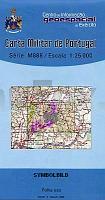
 | 95 - Topographische Landkarte Portugal 1:25.000 Carta Militar de Portugal - Série M888 Instituto Geográfico do Exército (IGeoE) - Portugal |
 | L3108 Lathen (geplottete Ausgabe) Topographische Karte 1:50.000 Kartografie Landesvermessungsamt Niedersachsen - ProjektNord |
 | 162-2 GRADEFES Amtliche topographische Landkarte 1:25.000 Spanien (M.T.N.) 162-2 Mapa Topográfico Nacional de Espana (MTN25) Instituto Geográfico Nacional - CNIG Spanien |
 | Hermannsweg - Eggeweg Ãber Herrmannshöhen durch Teutoburger Wald und Eggegebirge - OutdoorHandbuch - Der Weg ist das Ziel (Band 164) - Stein & GroÃelohmann Conrad-Stein-Verlag |
 | E01 Erlenbach a. Main - Elsenfeld, Obernburg a. Main, Wörth a. Main, GroÃheubach, Kleinwallstadt, Klingenberg a. Main ATK25 Topographische Karte 1:25.000 (Atkis) Bayern Landesvermessungsamt Bayern - Wanderkarte |