| << Portugal: Amtliche topografische Landkarten des Instituto Geográfico do Exército (IGeoE) 1:25.000 (Serie M888) |
||
|
||

Zuletzt angesehene Artikel:
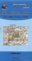
 | 100 - Topographische Landkarte Portugal 1:25.000 Carta Militar de Portugal - Série M888 Instituto Geográfico do Exército (IGeoE) - Portugal |
 | N-34-54-C/D Bagrationowsk Amtliche topographische Landkarte Polen 1:50.000 N-34-54-C/D Bagrationowsk - Mapa Topograficzna Polski Glowny Geodeta Kraju |
 | Stockholmer Schärengebiet - Schlittschuhführer schwedisch - Calazo Förlag Skrinnarens guide till Stockholms skärgård Calazo Förlag Schweden |
 | L3133 Korpoström Topographische Karte 1:25.000 EUREF (Peruskartta) Maanmittauslaitos / Lantmäteriverket Finnland - ProjektNord |
| MB12 Blekinge skärgård Topographische Wanderkarte mit Gewässerinformationen 1:50.000 - Doppelblatt Blekinge skärgård - Dubbelkarta, Terrängkarta med sjöinfo UTEKARTAN - Schweden |
| N-34-37/38 Wladyslawowo (GroÃendorf) Plot aus der Kartengrundlage der amtliche topographische Karte Polen 1:100.000 ProjektNord |
 | Rybnik - Loslau Stadtplan 1:20.000 Landkarte Rybnik, Wodzisław Śląski plan miasta Daunpol - Polen |