| << Portugal: Amtliche topografische Landkarten des Instituto Geográfico do Exército (IGeoE) 1:25.000 (Serie M888) |
||
|
||

Zuletzt angesehene Artikel:
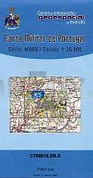
 | 103 - Topographische Landkarte Portugal 1:25.000 Carta Militar de Portugal - Série M888 Instituto Geográfico do Exército (IGeoE) - Portugal |
 | 0034-2 MURIEDAS Topographische Landkarte 1:25.000 Spanien (Grundlage MTN25) Instituto Geográfico Nacional - CNIG Spanien - ProjektNord |
 | K3441 Vättlax Topographische Karte 1:25.000 EUREF (Peruskartta) Maanmittauslaitos / Lantmäteriverket Finnland - ProjektNord |
 | 115 Valpelline - Valle di Ollomont - Valle di St. Barthelemy - Topographische Wanderkarte 1:30.000 - IGC Italien |
 | 0706-2 BUTRERA Topographische Landkarte 1:25.000 Spanien (Grundlage MTN25) Instituto Geográfico Nacional - CNIG Spanien - ProjektNord |
 | 0070-3 ORDES Topographische Landkarte 1:25.000 Spanien (Grundlage MTN25) Instituto Geográfico Nacional - CNIG Spanien - ProjektNord |
 | 25-21 Novy Jecin (Neutitschein) Topographische Karte 1:50.000 der Tschechischen Republik Zakladnà mapa Ceská republika - Cesky urad zememericky a katastralni - ProjektNord |
 | N4224 Töysä Topographische Karte 1:25.000 EUREF (Peruskartta) Maanmittauslaitos / Lantmäteriverket Finnland - ProjektNord |
 | Blatt 7B: Sant`Anna di Vinadio - Ceresole Reale 1:50.000 - Wanderkarte - Sentiero Italia Piemonte CAI - 4land / Idea Montagna Carta itineraria del Sentiero Italia tratto piemontese, da Sant`Anna di Vinadio a Ceresole Reale 4land / Idea Montagna |
 | 0496-1 CRETAS Topographische Landkarte 1:25.000 Spanien (Grundlage MTN25) Instituto Geográfico Nacional - CNIG Spanien - ProjektNord |
 | 0817-2 PÃTROLA Topographische Landkarte 1:25.000 Spanien (Grundlage MTN25) Instituto Geográfico Nacional - CNIG Spanien - ProjektNord |
 | Weschkeliza - Ozero Vedlozero (Karelien) 1:100.000 Topographische Landkarte Russland Weshkelica - Wedlozero (Respublika Karelia) - Karta - Aerogeodezija Aerogeodezia Russland |
 | 0802 LA ALBUERA Topographische Landkarte 1:50.000 Spanien (Grundlage MTN50) Instituto Geográfico Nacional - CNIG Spanien - ProjektNord |
 | 2110 (NL 32-06-10) Meran Topographische Wanderkarte 1:50.000 mit Wegmarkierungen - Ãsterreich - Kartographie BEV - ProjektNord |
 | 0332 VIC Topographische Landkarte 1:50.000 Spanien (Grundlage MTN50) Instituto Geográfico Nacional - CNIG Spanien - ProjektNord |
 | 0072-3 FRIOL Topographische Landkarte 1:25.000 Spanien (Grundlage MTN25) Instituto Geográfico Nacional - CNIG Spanien - ProjektNord |
 | Bergisches Land - Homburger Ländchen Topographische Wanderkarte Nordrhein-Westfalen mit Wanderwegen und Radwegen 1:25.000 - ProjektNord |
 | 6214 Alzey - Wanderkarte mit Wanderwegen (geplottete Ausgabe) ProjektNord - Grundlage Amtliche topographische Karte Landesamt für Vermessung und Geobasisinformation Rheinland-Pfalz |
 | 0547 ALCANAR Topographische Landkarte 1:50.000 Spanien (Grundlage MTN50) Instituto Geográfico Nacional - CNIG Spanien - ProjektNord |
 | Maramureș 1:35.000 (Blatt 12) Touristische Wanderkarte - Bergwanderkarte Mara - Cosău - Creasta Cocoșului - Harta turistica / Tourist map Zenith - Rumänien |