
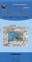
| << Portugal: Amtliche topografische Landkarten des Instituto Geográfico do Exército (IGeoE) 1:25.000 (Serie M888) |
||
|
||


Zuletzt angesehene Artikel:
 | 109 - Topographische Landkarte Portugal 1:25.000 Carta Militar de Portugal - Série M888 Instituto Geográfico do Exército (IGeoE) - Portugal |
 | 5903 Neuerburg - Wanderkarte mit Wanderwegen (geplottete Ausgabe) ProjektNord - Grundlage Amtliche topographische Karte Landesamt für Vermessung und Geobasisinformation Rheinland-Pfalz |
 | 183 Andorra La Vella Amtliche topographische Landkarte 1:50.000 Spanien (M.T.N.) 183 Mapa Topográfico Nacional de Espana (MTN50) Instituto Geográfico Nacional - CNIG Spanien |
 | 353 - Topographische Landkarte Portugal 1:25.000 Carta Militar de Portugal - Série M888 Instituto Geográfico do Exército (IGeoE) - Portugal |
 | 328 Artesa de Segre Amtliche topographische Landkarte 1:50.000 Spanien (M.T.N.) 328 Mapa Topográfico Nacional de Espana (MTN50) Instituto Geográfico Nacional - CNIG Spanien |
 | 795 (29-31) Xátiva Amtliche topographische Landkarte 1:50.000 Spanien (M.T.N.) 795 Mapa Topográfico Nacional de Espana (MTN50) Instituto Geográfico Nacional - CNIG Spanien |
 | 189 A Pobra de Trives Amtliche topographische Landkarte 1:50.000 Spanien (M.T.N.) 189 Mapa Topográfico Nacional de Espana (MTN50) Instituto Geográfico Nacional - CNIG Spanien |
 | 2425 Hamburg - Gestern und Heute - Historische Überlagerung 1902-1930 Topographische Landkarte 1:25.000 im Vergleich - Landesvermessungsamt Schleswig-Holstein / ProjektNord |
 | 809-4 VIÑUELA Amtliche topographische Landkarte 1:25.000 Spanien (M.T.N.) 809-4 Mapa Topográfico Nacional de Espana (MTN25) Instituto Geográfico Nacional - CNIG Spanien |
 | 0713-1 VILLAFRANCA DE LOS CABALLEROS Topographische Landkarte 1:25.000 Spanien (Grundlage MTN25) Instituto Geográfico Nacional - CNIG Spanien - ProjektNord |
 | 0789 LEZUZA Topographische Landkarte 1:50.000 Spanien (Grundlage MTN50) Instituto Geográfico Nacional - CNIG Spanien - ProjektNord |
 | Irkutsker Oblast - Straßenkarte 1:1 Mio. / 1:1.2 Mio. Irkutskaja Oblast` Karta awtomobilnyh dorog VostSib AGP - Russland |
 | 764 Munera Amtliche topographische Landkarte 1:50.000 Spanien (M.T.N.) 764 Mapa Topográfico Nacional de Espana (MTN50) Instituto Geográfico Nacional - CNIG Spanien |
 | Niederlande - Belgien und Luxemburg Historische Karte um 1900 (Reprint PLANO) - von Handtke, Friedrich (Kartograf) Rockstuhl, Harald (Mitwirkender) - Verlag Rockstuhl |
 | Korsika mit Kindern *** SCHNÄPPCHEN *** 50 Wander- und Entdeckertouren in dem Bergen und am Meer - Reiseführer von Stefanie Holtkamp - Naturzeit Reiseverlag |
 | 941 (13-38) Mulva Amtliche topographische Landkarte 1:50.000 Spanien (M.T.N.) 941 Mapa Topográfico Nacional de Espana (MTN50) Instituto Geográfico Nacional - CNIG Spanien |
 | Jersey & Guernsey 1:18.000 Straßenkarte ITMB International Travel Maps |
 | 2012 09 Ylönkylä Topographische Karte 1:20.000 (Maastokartta / Peruskartta / Grundkarta) Maanmittauslaitos / Lantmäteriverket Finnland - ProjektNord |
 | 2415-II-SØ Topographische Karte Dänemark 1:25.000 Topografisk kort Danmark (DTK/Kort25) 2415-II-SØ ProjektNord - Kort & Matrikelstyrelsen / Geodætisk Institut |
| 3141-SO Topographische Karte 1:10.000 - Landesvermessungsamt Brandenburg |