
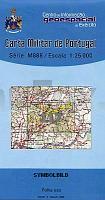
| << Portugal: Amtliche topografische Landkarten des Instituto Geográfico do Exército (IGeoE) 1:25.000 (Serie M888) |
||
|
||

Zuletzt angesehene Artikel:
 | 117 - Topographische Landkarte Portugal 1:25.000 Carta Militar de Portugal - Série M888 Instituto Geográfico do Exército (IGeoE) - Portugal |
 | 0680 ALDEACENTENERA Topographische Landkarte 1:50.000 Spanien (Grundlage MTN50) Instituto Geográfico Nacional - CNIG Spanien - ProjektNord |
 | 0444-1 RIBA-ROJA DEBRE Topographische Landkarte 1:25.000 Spanien (Grundlage MTN25) Instituto Geográfico Nacional - CNIG Spanien - ProjektNord |
 | 2113-IV-SV Topographische Karte Dänemark 1:25.000 Topografisk kort Danmark (DTK/Kort25) 2113-IV-SV ProjektNord - Kort & Matrikelstyrelsen / Geodætisk Institut |
 | N12 Garching - Ismaning, Markt Schwaben, Neufahrn b. Freising, Moosinning, Poing, Kirchheim b. München ATK25 Topographische Landkarte 1:25.000 (Atkis) Bayern Landesvermessungsamt Bayern - Wanderkarte |
 | Anhalt-Zerbst Nord (Blatt 12) Topographische Kreiskarte Wandern und Radwandern 1:50.000 vom Landesvermessungsamt Sachsen-Anhalt |
 | 0546 ULLDECONA Topographische Landkarte 1:50.000 Spanien (Grundlage MTN50) Instituto Geográfico Nacional - CNIG Spanien - ProjektNord |
 | 352-2 AMBEL Amtliche topographische Landkarte 1:25.000 Spanien (M.T.N.) 352-2 Mapa Topográfico Nacional de Espana (MTN25) Instituto Geográfico Nacional - CNIG Spanien |
 | 0571-3 SANTA MAGDALENA DE PULPIS Topographische Landkarte 1:25.000 Spanien (Grundlage MTN25) Instituto Geográfico Nacional - CNIG Spanien - ProjektNord |
 | Krim Tschatyrdah Topographische Wanderkarte 1:50.000 Krim - Ukraine ukrmap Chatyrdah, Чатырдаг Kartografija - ukrmap Ukraine |
 | 0151 RIBEIRA Topographische Landkarte 1:50.000 Spanien (Grundlage MTN50) Instituto Geográfico Nacional - CNIG Spanien - ProjektNord |
 | 6315 Worms-Pfeddersheim - Wanderkarte mit Wanderwegen (geplottete Ausgabe) ProjektNord - Grundlage Amtliche topographische Karte Landesamt für Vermessung und Geobasisinformation Rheinland-Pfalz |
 | 32 Bad Wurzach - Ochsenhausen 1:35.000 Topographische Wanderkarte Landesvermessungsamt Baden-Württemberg - Schwäbischer Albverein |
 | 0632-2 FUENTE DE PEDRO NAHARRO Topographische Landkarte 1:25.000 Spanien (Grundlage MTN25) Instituto Geográfico Nacional - CNIG Spanien - ProjektNord |
 | V4323 Pokka Topographische Karte 1:25.000 EUREF (Peruskartta) Maanmittauslaitos / Lantmäteriverket Finnland - ProjektNord |
 | 6106 Schweich - Wanderkarte mit Wanderwegen (geplottete Ausgabe) ProjektNord - Grundlage Amtliche topographische Karte Landesamt für Vermessung und Geobasisinformation Rheinland-Pfalz |
 | 0574-2 CASAR DE PALOMERO Topographische Landkarte 1:25.000 Spanien (Grundlage MTN25) Instituto Geográfico Nacional - CNIG Spanien - ProjektNord |
 | 4230 (NL 33-02-30) Gleisdorf Topographische Wanderkarte 1:50.000 mit Wegmarkierungen - Österreich - Kartographie BEV - ProjektNord |
 | 91 Ytterhogdal 1:50.000 (wasserfest) *** SCHNÄPPCHEN *** Topographische Wanderkarte - Sverigeserien Topo50 - Schweden Norstedts |
 | 3371 Modlin Topographische Karte 1:25.000 Messtischblatt des Deutschen Reiches - Preußische Landesaufnahme / Reichsamt für Landesaufnahme - Faksimile ProjektNord |