
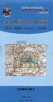
| << Portugal: Amtliche topografische Landkarten des Instituto Geográfico do Exército (IGeoE) 1:25.000 (Serie M888) |
||
|
||


Zuletzt angesehene Artikel:
 | 129 - Topographische Landkarte Portugal 1:25.000 Carta Militar de Portugal - Série M888 Instituto Geográfico do Exército (IGeoE) - Portugal |
 | 43A DIRKSLAND Topographische Karte der Niederlande 1:25.000 (Plotausgabe) 43A DIRKSLAND Topografische Kaart van Nederland Kadaster - ProjektNord |
 | Historischer Atlas der antiken Welt Herausgeber: Cancik, Hubert; Landfester, Manfred; Schneider, Helmuth. Hrsg. v. Anne-Maria Wiitke u. Eckart Olshausen. Karten: Richard Szydlak - Verlag J.B. Metzler |
 | 762-2 TOMELLOSO Amtliche topographische Landkarte 1:25.000 Spanien (M.T.N.) 762-2 Mapa Topográfico Nacional de Espana (MTN25) Instituto Geográfico Nacional - CNIG Spanien |
 | 04F OOST-VLIELAND Topographische Karte der Niederlande 1:25.000 (Plotausgabe) 04F OOST-VLIELAND Topografische Kaart van Nederland Kadaster - ProjektNord |
 | 0459-4 TAMAJÓN Topographische Landkarte 1:25.000 Spanien (Grundlage MTN25) Instituto Geográfico Nacional - CNIG Spanien - ProjektNord |
 | L5241 Ylämaa Topographische Karte 1:25.000 EUREF (Peruskartta) Maanmittauslaitos / Lantmäteriverket Finnland - ProjektNord |
 | Walks around Ambleside: Grasmere - Langdale & Etterwater - Wanderkarte A map-guide to 14 walks around Ambleside, in the English Lake District - Footprint Maps - Stirling Surveys |
 | 66 - Topographische Landkarte Portugal 1:25.000 Carta Militar de Portugal - Série M888 Instituto Geográfico do Exército (IGeoE) - Portugal |
 | 0605-1 ILLESCAS Topographische Landkarte 1:25.000 Spanien (Grundlage MTN25) Instituto Geográfico Nacional - CNIG Spanien - ProjektNord |
 | Preussische Provinz Sachsen, 1870/71 - Historische Landkarte Nachdruck Planokarte - gerollt von Handke, Friedrich - Verlag Rockstuhl |
 | 0056-2 PANES Topographische Landkarte 1:25.000 Spanien (Grundlage MTN25) Instituto Geográfico Nacional - CNIG Spanien - ProjektNord |
 | 1008-2 MONTEFRÍO Topographische Landkarte 1:25.000 Spanien (Grundlage MTN25) Instituto Geográfico Nacional - CNIG Spanien - ProjektNord |
 | 195-2 EL BURGO RANERO Amtliche topographische Landkarte 1:25.000 Spanien (M.T.N.) 195-2 Mapa Topográfico Nacional de Espana (MTN25) Instituto Geográfico Nacional - CNIG Spanien |
 | 0588-4 ZAFRILLA Topographische Landkarte 1:25.000 Spanien (Grundlage MTN25) Instituto Geográfico Nacional - CNIG Spanien - ProjektNord |
 | 0539-4 LAGUNASECA Topographische Landkarte 1:25.000 Spanien (Grundlage MTN25) Instituto Geográfico Nacional - CNIG Spanien - ProjektNord |
 | 0328 ARTESA DE SEGRE Topographische Landkarte 1:50.000 Spanien (Grundlage MTN50) Instituto Geográfico Nacional - CNIG Spanien - ProjektNord |
 | Slowinzischer Nationalpark - Leba, Stolpmünde, Rowen, Lauenburg Slowinski Park Narodowy - Leba, Ustka, Rowy, Lebork Wanderkarte und Touristische Landkarte Polen 1:100.000 - FOTKART Polen |
 | 0350 SORIA Topographische Landkarte 1:50.000 Spanien (Grundlage MTN50) Instituto Geográfico Nacional - CNIG Spanien - ProjektNord |
 | 0854 ZAFRA Topographische Landkarte 1:50.000 Spanien (Grundlage MTN50) Instituto Geográfico Nacional - CNIG Spanien - ProjektNord |