| << Portugal: Amtliche topografische Landkarten des Instituto Geográfico do Exército (IGeoE) 1:25.000 (Serie M888) |
||
|
||

Zuletzt angesehene Artikel:
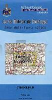
 | 131 - Topographische Landkarte Portugal 1:25.000 Carta Militar de Portugal - Série M888 Instituto Geográfico do Exército (IGeoE) - Portugal |
 | Mittleres Pilitza-Tal Wanderkarte 1:75.000 Wasserfeste Landkarte, Wanderkarte, Kanurouten Dolina Środkowej Pilicy Compass - Polen |
 | Cycling in Surrey - 21 hand-picked rides Fahrradführer (englisch) Bradt Publications |
 | Kerman Province (Blatt 393) 1:1 Mio. Landkarte Englisch und Persisch (Nr. 393) نقشه استان كرمان Gitashenasi - Iran |
 | Kaohsiung Stadtplan Taiwan Kaohsiung City Travel Map Periplus Editors |
 | Winter in der Tatra - Wintersportkarte - Touristische Landkarte 1:90.000 Zima pod Tatrami Compass - Polen |
| 2663 Petznick Topographische Karte 1:25.000 Messtischblatt des Deutschen Reiches - PreuÃische Landesaufnahme / Reichsamt für Landesaufnahme - Faksimile ProjektNord |
| 252.42 Amtliche topographische Karte 1:25.000 Polen |
 | 306 Rund um GieÃen (GieÃener Land) 1:40.000 Rad- und Wanderkarte mit Rettungspunkten Rundwanderwege mit Beschreibung auf der Rückseite GW Rheingau-Taunus-Kartographie |
 | Persien Meine Reisen durch den Iran - von Jason Elliot - Piper Verlag |
 | 21G ZWOLLE Topographische Karte der Niederlande 1:25.000 (Plotausgabe) 21G ZWOLLE Topografische Kaart van Nederland Kadaster - ProjektNord |
 | Südnorwegen Reiseführer Michael-Müller-Verlag - Reiseführer |
 | 3719 Minden (geplottete Ausgabe) Amtliche topographische Karte 1:25.000 Landesvermessungsamt Nordrhein-Westfalen |
 | Loiret Randonnée (Blatt 3) 1:50.000 Jargeau - Bellegarde Plein-Air Wanderkarte Frankreich - IGN Frankreich |
 | Baedeker Reiseführer Menorca von Eisenschmid, Rainer |
 | Florida & South Nationalpark Reiseführer Lonely Planet (engl.) |
 | Ladoga-See 1:120.000 Topographischer StraÃenatlas Вокруг Ладоги - Атлас для водителей Karta LTD S. Petersburg |
| 2469 Pr. Friedland Topographische Karte 1:25.000 Messtischblatt des Deutschen Reiches - PreuÃische Landesaufnahme / Reichsamt für Landesaufnahme - Faksimile ProjektNord |
| 441.44 Amtliche topographische Karte 1:25.000 Polen |
 | Baedeker Reiseführer Usedom MAIRDUMONT |