| << Portugal: Amtliche topografische Landkarten des Instituto Geográfico do Exército (IGeoE) 1:25.000 (Serie M888) |
||
|
||

Zuletzt angesehene Artikel:
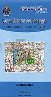
 | 153 - Topographische Landkarte Portugal 1:25.000 Carta Militar de Portugal - Série M888 Instituto Geográfico do Exército (IGeoE) - Portugal |
 | 7 Valli Maira - Grana - Stura - Topographische Wanderkarte 1:50.000 - IGC Italien |
 | 4249-SO Topographische Karte 1:10.000 - Landesvermessungsamt Brandenburg |
 | 2211-IV Tinglev - mit Wanderwegen und Fahrradrouten Topographische Fahrradkarte und Wanderkarte Dänemark 1:50.000 - Kort & Matrikelstyrelsen ProjektNord 2211-IV Tinglev - Topografisk Cykel- og Vandrekort Danmark |
 | Lemberg Zentrum Stadtplan 1:8.000 Lwiw Kartografija - ukrmap Ukraine |
 | 761 Llanos del Caudillo Amtliche topographische Landkarte 1:50.000 Spanien (M.T.N.) 761 Mapa Topográfico Nacional de Espana (MTN50) Instituto Geográfico Nacional - CNIG Spanien |
| 3553-SO Topographische Karte 1:10.000 - Landesvermessungsamt Brandenburg |
 | Aisne Sud à VTT - vol. 2 - Nord / Picardie / Champagne Wanderführer - Mountainbikeführer (französisch) Aisne Sud à VTT - vol. 2 - Nord / Picardie / Champagne - Itinéraires VTT & vélo - carto-guide: fiches+livret pratique Chamina - Frankreich |
 | 102 - Topographische Landkarte Portugal 1:25.000 Carta Militar de Portugal - Série M888 Instituto Geográfico do Exército (IGeoE) - Portugal |
 | Winnyzja Stadtplan 1:18.000 (kyrillisch) Вінниця Kartografija - ukrmap Ukraine |
 | 83 Vila Nova de Famalicao - Topographische Landkarte Portugal 1:25.000 Carta Militar de Portugal - Série M888 Instituto Geográfico do Exército (IGeoE) - Portugal |
 | Königreich Bayern - um 1900 (Reprint PLANO) - von Handtke, Friedrich (Kartograf) - Verlag Rockstuhl |
 | 261 - Topographische Landkarte Portugal 1:25.000 Carta Militar de Portugal - Série M888 Instituto Geográfico do Exército (IGeoE) - Portugal |