| << Portugal: Amtliche topografische Landkarten des Instituto Geográfico do Exército (IGeoE) 1:25.000 (Serie M888) |
||
|
||

Zuletzt angesehene Artikel:
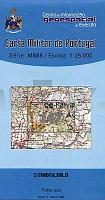
 | 167 - Topographische Landkarte Portugal 1:25.000 Carta Militar de Portugal - Série M888 Instituto Geográfico do Exército (IGeoE) - Portugal |
 | John O`Groats Trail XT40 Wanderkarte - HARVEY MAPS |
 | Europa, um 1910 (Plano) - Historische Landkarte Nachdruck Planokarte - gerollt - Verlag Rockstuhl |
 | Abruzzen-Nationalpark - Latium und Molise 1:25.000 (ALM) Wanderkartenset (wasserfest und reiÃfest) Italien - D.R.E.A.M. Italia Parco Nazionale d´Abruzzo, Lazio e Molise |
 | 02-214 Topographische Karte 1:25.000 der Tschechischen Republik Zakladnà mapa Ceská republika Cesky urad zememericky a katastralni - ProjektNord |
 | 2285 Osterode in OstpreuÃen Topographische Karte 1:25.000 Messtischblatt des Deutschen Reiches - PreuÃische Landesaufnahme / Reichsamt für Landesaufnahme - Faksimile ProjektNord |
 | CityTrip Kapstadt Werner, Klaus - von Dieter Losskarn - Reise Know-How Verlag |
 | Gebrauchsanweisung für Katalonien - von Michael Ebmeyer - Piper Verlag |
 | Powiat człuchowski 1:75 000 Touristische Landkarte - Polen Compass - Polen |
 | 25-112 Topographische Karte 1:25.000 der Tschechischen Republik Zakladnà mapa Ceská republika Cesky urad zememericky a katastralni - ProjektNord |
 | 03-244 Topographische Karte 1:25.000 der Tschechischen Republik Zakladnà mapa Ceská republika Cesky urad zememericky a katastralni - ProjektNord |
| Pocatello / Blackfoot / American Falls / SE Idaho Stadtplan 1:32.000 (Idaho - USA) Pocatello / Blackfoot / American Falls / SE Idaho street map GM Johnson |
 | L7528 Dillingen (geplottete Ausgabe) Topographische Karte Bayern 1:50.000 Bayerisches Landesvermessungsamt |
 | Urner Alpen Band 3 Vom Susten zum Urirotstock Alpinführer Schweizer Alpen Schweizer Alpen-Club |
| Krasnoselz Topographische Karte 1:25.000 Messtischblatt des Deutschen Reiches - PreuÃische Landesaufnahme / Reichsamt für Landesaufnahme - Faksimile ProjektNord |
 | Denk doch - was du willst Die Freiheit der Gedanken - von Thorsten Havener - Wunderlich |
| 263.12 Amtliche topographische Karte 1:25.000 Polen |
| N-34-139-A/B Warszawa East Amtliche topographische Landkarte Polen 1:50.000 N-34-139-A/B Warszawa East - Mapa Topograficzna Polski Glowny Geodeta Kraju |
| 224.22 Amtliche topographische Karte 1:25.000 Polen |
 | 3 in 1 City Map Lausanne 1:11.500 Stadtplan Map, Travel information, Highlights, Sightseeing, Index |