
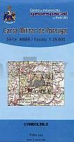
| << Portugal: Amtliche topografische Landkarten des Instituto Geográfico do Exército (IGeoE) 1:25.000 (Serie M888) |
||
|
||


Zuletzt angesehene Artikel:
 | 180 - Topographische Landkarte Portugal 1:25.000 Carta Militar de Portugal - Série M888 Instituto Geográfico do Exército (IGeoE) - Portugal |
 | 0583 ARGANDA DEL REY Topographische Landkarte 1:50.000 Spanien (Grundlage MTN50) Instituto Geográfico Nacional - CNIG Spanien - ProjektNord |
 | 0911-1 CEHEGÍN Topographische Landkarte 1:25.000 Spanien (Grundlage MTN25) Instituto Geográfico Nacional - CNIG Spanien - ProjektNord |
 | 0277 SALAS DE LOS INFANTES Topographische Landkarte 1:50.000 Spanien (Grundlage MTN50) Instituto Geográfico Nacional - CNIG Spanien - ProjektNord |
 | 0564-4 EL HOSQUILLO Topographische Landkarte 1:25.000 Spanien (Grundlage MTN25) Instituto Geográfico Nacional - CNIG Spanien - ProjektNord |
 | Königssee 45 Touren - mit Nationalpark Berchtesgaden und Watzmann - von Kühnhauser, Bernhard und Kühnhauser, Christina - Rother Bergverlag |
 | Tara Dornelor 1:53.000 (Blatt 9) wasserfeste Karte, rumänisch -englisch Ţara Dornelor Harta turistica / Tourist map Zenith - Rumänien |
 | Auschwitzer Land 1:50.000 Wanderkarte / Landkarte Polen - PLAN galileos - Polen Ziemia Oświęcimska - Dolina Karpia Compass - Polen |
 | 0625 LAGARTERA Topographische Landkarte 1:50.000 Spanien (Grundlage MTN50) Instituto Geográfico Nacional - CNIG Spanien - ProjektNord |
 | 0064-1 ZARAUTZ Topographische Landkarte 1:25.000 Spanien (Grundlage MTN25) Instituto Geográfico Nacional - CNIG Spanien - ProjektNord |
 | 70-2 MESÍA Amtliche topographische Landkarte 1:25.000 Spanien (M.T.N.) 70-2 Mapa Topográfico Nacional de Espana (MTN25) Instituto Geográfico Nacional - CNIG Spanien |
 | 610-4 LAS TORCAS Amtliche topographische Landkarte 1:25.000 Spanien (M.T.N.) 610-4 Mapa Topográfico Nacional de Espana (MTN25) Instituto Geográfico Nacional - CNIG Spanien |
 | 0546-2 ULLDECONA Topographische Landkarte 1:25.000 Spanien (Grundlage MTN25) Instituto Geográfico Nacional - CNIG Spanien - ProjektNord |
 | 0663 VALERA DE ABAJO Topographische Landkarte 1:50.000 Spanien (Grundlage MTN50) Instituto Geográfico Nacional - CNIG Spanien - ProjektNord |
 | 4606 GT Île St-Martin - Île St-Barthélemy - Französische Antillen *** SCHNÄPPCHEN *** 1:25.000 Topographische Wanderkarte IGN (TOP25) Île St-Martin, Île St-Barthélemy, Guadeloupe |
 | 0045-4 ABEGONDO Topographische Landkarte 1:25.000 Spanien (Grundlage MTN25) Instituto Geográfico Nacional - CNIG Spanien - ProjektNord |
 | 715-3 LAS MESAS Amtliche topographische Landkarte 1:25.000 Spanien (M.T.N.) 715-3 Mapa Topográfico Nacional de Espana (MTN25) Instituto Geográfico Nacional - CNIG Spanien |
 | 0119-4 PORTO DO SON Topographische Landkarte 1:25.000 Spanien (Grundlage MTN25) Instituto Geográfico Nacional - CNIG Spanien - ProjektNord |
 | Q5421 Juonto Topographische Karte 1:25.000 EUREF (Peruskartta) Maanmittauslaitos / Lantmäteriverket Finnland - ProjektNord |
 | 910-2 CARAVACA DE LA CRUZ Amtliche topographische Landkarte 1:25.000 Spanien (M.T.N.) 910-2 Mapa Topográfico Nacional de Espana (MTN25) Instituto Geográfico Nacional - CNIG Spanien |