| << Portugal: Amtliche topografische Landkarten des Instituto Geográfico do Exército (IGeoE) 1:25.000 (Serie M888) |
||
|
||

Zuletzt angesehene Artikel:
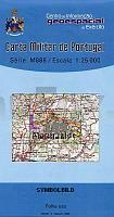
 | 189 - Topographische Landkarte Portugal 1:25.000 Carta Militar de Portugal - Série M888 Instituto Geográfico do Exército (IGeoE) - Portugal |
 | 498 - Grega Topographische Landkarte Portugal 1:25.000 Carta Militar de Portugal - Série M888 Instituto Geográfico do Exército (IGeoE) - Portugal |
 | A7 Kongsfjorden *** SCHNÃPPCHEN *** Spitzbergen / Svalbard / Spitsbergen - Topographische Karte 1:100.000 Norsk Polarinstitutt |
 | Südliches Baikalsee-Umland - Topografischer Atlas 1:100.000 Russland Juznoje Pribajkale Atlas (South part of Baikal Lake) Irkutskaya Kartografitscheskaya Fabrika (Russland) - VostSib AGP |
 | 467 - Topographische Landkarte Portugal 1:25.000 Carta Militar de Portugal - Série M888 Instituto Geográfico do Exército (IGeoE) - Portugal |
 | Teutoburger Wald 3 - Borgholzhausen - Halle (Westf.) Topographische Wanderkarte Nordrhein-Westfalen mit Wanderwegen und Radwegen 1:25.000 - ProjektNord |
 | Teutoburger Wald 2 - Bad Iburg - Bad Rothenfelde Topographische Wanderkarte Nordrhein-Westfalen mit Wanderwegen und Radwegen 1:25.000 - ProjektNord |
 | Welt politisch - pazifikzentriert - groÃe Ausgabe PLANO-Karte 1:22.445 Mio. (Format: 185 x 122 cm) - gerollt im Plastikrohr World political flat map enlarged Pacific centered National Geographic |
 | 289 Serta - Topographische Landkarte Portugal 1:25.000 Carta Militar de Portugal - Série M888 Instituto Geográfico do Exército (IGeoE) - Portugal |
 | NJ 37-6 Malatya Amtliche Topographische Karte der Türkei 1:250.000 NJ 37-6 Malatya - Müşterek Harekat Haritası HGK |
 | 333 - Topographische Landkarte Portugal 1:25.000 Carta Militar de Portugal - Série M888 Instituto Geográfico do Exército (IGeoE) - Portugal |
| 3347-SO Topographische Karte 1:10.000 - Landesvermessungsamt Brandenburg |
 | Saqqisikuik / Skjoldungen (Blatt 8) 1:500.000 VIKING Polar Cruise Series Topographische Landkarte Saga Maps Grönland |
 | Harz 1:75.000 (Blatt RK-SAA05) *** SCHNÃPPCHEN *** Halberstadt - Quedlingburg - Werningerode - Thale - Nationalpark Harz - Brocken - bikeline-Radkarte Deutschland Esterbauer |
 | 359 Balaguer Amtliche topographische Landkarte 1:50.000 Spanien (M.T.N.) 359 Mapa Topográfico Nacional de Espana (MTN50) Instituto Geográfico Nacional - CNIG Spanien |
 | 686 Turleque Amtliche topographische Landkarte 1:50.000 Spanien (M.T.N.) 686 Mapa Topográfico Nacional de Espana (MTN50) Instituto Geográfico Nacional - CNIG Spanien |
 | 516 - Santiago Do Cacem Topographische Landkarte Portugal 1:25.000 Carta Militar de Portugal - Série M888 Instituto Geográfico do Exército (IGeoE) - Portugal |
 | ADAC Campingführer Südeuropa 2024 *** SCHNÃPPCHEN *** 2900 Campingplätze. Albanien, Andorra, Bosnien und Herzegowina, Bulgarien, Frankreich, Griechenland, Italien, Kroatien, Malta, Mazedonien, Montenegro, Ãsterreich, Portugal, Rumänien, Schweiz, Serbien, Slowenien, Spanien, Türkei, Ungarn - ADAC |
 | 4051 Lieberose Sonderausgabe mit Wanderwegen - Topographische Wanderkarte Brandenburg 1:25.000 ProjektNord |
 | Parco Nazionale dello Stelvio - Carta 3 - Valcamonica - Passo Gavia e Val di Rezzalo - Topographische Wanderkarte 1:25.000 Ingenia Editori - Italien |