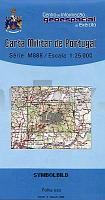
| << Portugal: Amtliche topografische Landkarten des Instituto Geográfico do Exército (IGeoE) 1:25.000 (Serie M888) |
||
|
||

Zuletzt angesehene Artikel:
 | 198 - Topographische Landkarte Portugal 1:25.000 Carta Militar de Portugal - Série M888 Instituto Geográfico do Exército (IGeoE) - Portugal |
 | N4231 Pihlajavesi Topographische Karte 1:25.000 EUREF (Peruskartta) Maanmittauslaitos / Lantmäteriverket Finnland - ProjektNord |
 | Asien politisch Antik PLANO-Karte 1:13.812 Mio. (Format: 85 x 96 cm) - gerollt im Plastikrohr Asia political antique flat map National Geographic |
 | 2214-II-NV Topographische Karte Dänemark 1:25.000 Topografisk kort Danmark (DTK/Kort25) 2214-II-NV ProjektNord - Kort & Matrikelstyrelsen / Geodætisk Institut |
 | 2212-II-Nà Topographische Karte Dänemark 1:25.000 Topografisk kort Danmark (DTK/Kort25) 2212-II-Nà ProjektNord - Kort & Matrikelstyrelsen / Geodætisk Institut |
 | W267 Stühlingen - Wanderkarte 1:25.000 Randen, Wutachtal, Schaffhausen - von LGL - Landesamt für Geoinformation und Landentwicklung Baden-Württemberg (LGL) |
 | 0988 PUENTE GENIL Topographische Landkarte 1:50.000 Spanien (Grundlage MTN50) Instituto Geográfico Nacional - CNIG Spanien - ProjektNord |
 | 0152 VILAGARCÃA Topographische Landkarte 1:50.000 Spanien (Grundlage MTN50) Instituto Geográfico Nacional - CNIG Spanien - ProjektNord |
 | Alta Via delle Cinque Terre 1:25.000 - e Alta Via del Golfo - Topographischer Wanderführer - Geo4 Map - Italien Atlante cartografico dell`Alta Via delle Cinque Terre e dell`Alta Via del Golfo di La Spezia |
 | 406-2 ALMAZÃN Amtliche topographische Landkarte 1:25.000 Spanien (M.T.N.) 406-2 Mapa Topográfico Nacional de Espana (MTN25) Instituto Geográfico Nacional - CNIG Spanien |
 | Leningrader Oblast - Sankt-Petersburg Topografischer Atlas 1:200.000 Leningradskaja oblastj - Sankt-Petersburg - Roskartografia - Russland |
 | 1000-1 MOGUER Topographische Landkarte 1:25.000 Spanien (Grundlage MTN25) Instituto Geográfico Nacional - CNIG Spanien - ProjektNord |
 | 0274-3 VILLALOBÃN Topographische Landkarte 1:25.000 Spanien (Grundlage MTN25) Instituto Geográfico Nacional - CNIG Spanien - ProjektNord |
 | 0203 NÃJERA Topographische Landkarte 1:50.000 Spanien (Grundlage MTN50) Instituto Geográfico Nacional - CNIG Spanien - ProjektNord |
 | 2411-II-NV Topographische Karte Dänemark 1:25.000 Topografisk kort Danmark (DTK/Kort25) 2411-II-NV ProjektNord - Kort & Matrikelstyrelsen / Geodætisk Institut |
 | 223 - Louriga (Seia) Topographische Landkarte 1:25.000 Carta Militar de Portugal - Série M888 Instituto Geográfico do Exército (IGeoE) - Portugal |
 | 0062-2 GERNIKA-LUMO Topographische Landkarte 1:25.000 Spanien (Grundlage MTN25) Instituto Geográfico Nacional - CNIG Spanien - ProjektNord |
 | N3424 Norinkylä Topographische Karte 1:25.000 EUREF (Peruskartta) Maanmittauslaitos / Lantmäteriverket Finnland - ProjektNord |
 | 05W HARLINGEN (West) Topographische Karte der Niederlande 1:50.000 Topografische Dienst (Plotausgabe) |