| << Portugal: Amtliche topografische Landkarten des Instituto Geográfico do Exército (IGeoE) 1:25.000 (Serie M888) |
||
|
||

Zuletzt angesehene Artikel:
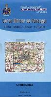
 | 200 - Topographische Landkarte Portugal 1:25.000 Carta Militar de Portugal - Série M888 Instituto Geográfico do Exército (IGeoE) - Portugal |
 | UK 50-44 Inn-Salzach-Region - Rupertiwinkel - Ãstlicher Chiemgau Mühldorf a.Inn, Töging a.Inn, Trostberg, Tittmoning, Laufen, Traunreut, Freilassing, Waginger See - Landesamt für Digitalisierung, Breitband und Vermessung, Bayern |
 | CC 6302 Trier Topographische Ãbersichtskarte 1:200.000 - Bundesamt für Kartografie und Geodäsie und Landesvermessungsämter - ProjektNord |
 | 11 Bayerischer Wald - Deggendorf - Passau - Bad Kötzting - 1:100.000 Wanderkarte, Radkarte (ATK100) Landesamt für Vermessung und Geoinformation Bayern |
 | UK 50-38 Kneippland Unterallgäu - Memmingen - Mindelheim Wanderkarte Bayern 1:50.000 mit Wanderwegen, mit Radwanderwegen, GPS-Gitter Bayerisches Landesvermessungsamt |
 | 19 Chiemgau - Rupertiwinkel - Rosenheim - Königgssee 1:100.000 Wanderkarte, Radkarte (ATK100) Landesamt für Vermessung und Geoinformation Bayern |
 | UK 50-26 Naturpark Oberer Bayerischer Wald westlicher Teil Roding - Nittenau - Schwandorf - Regensburg Ost Wanderkarte Bayern 1:50.000 mit Wanderwegen und Radwanderwegen, GPS-Gitter - Landesamt für Digitalisierung, Breitband und Vermessung (Landesvermessungsamt Bayern) |
 | Region Hannover 1:200.000 Topographische StraÃenkarte ProjektNord - Bundesamt f. Kartographie u. Geodäsie |
 | CC 3902 Lingen (Ems) Topographische Ãbersichtskarte 1:200.000 - Bundesamt für Kartografie und Geodäsie und Landesvermessungsämter - ProjektNord |
 | CC 6334 Bayreuth Topographische Ãbersichtskarte 1:200.000 - Bundesamt für Kartografie und Geodäsie und Landesvermessungsämter - ProjektNord |
 | UK 50-14 Naturpark Nördlicher Oberpfälzer Wald - Auerbach i.d.OPf. - Sulzbach-Rosenberg - Weiden i.d.OPf. - Windischeschenbach Wanderkarte Bayern 1:50.000 mit Wanderwegen und Radwanderwegen, GPS-Gitter - Landesamt für Digitalisierung, Breitband und Vermessung (Landesvermessungsamt Bayern) |
 | CC 2342 Stralsund Topographische Ãbersichtskarte 1:200.000 - Bundesamt für Kartografie und Geodäsie und Landesvermessungsämter - ProjektNord |
 | UK 50-9 Naturpark Steigerwald - südlicher Teil: Aischgrund - Bad Windsheim - Erlangen - Fürth - Kitzingen Wanderkarte Bayern 1:50.000 mit Wanderwegen und Radwanderwegen, GPS-Gitter - Landesamt für Digitalisierung, Breitband und Vermessung (Landesvermessungsamt Bayern) |
 | CC 4734 Leipzig Topographische Ãbersichtskarte 1:200.000 - Bundesamt für Kartografie und Geodäsie und Landesvermessungsämter - ProjektNord |
 | CC 8742 Bad Reichenhall Topographische Ãbersichtskarte 1:200.000 - Bundesamt für Kartografie und Geodäsie und Landesvermessungsämter - ProjektNord |
 | Region Dresden 1:200.000 Topographische StraÃenkarte ProjektNord - Bundesamt f. Kartographie u. Geodäsie |
 | C7138 Regensburg (Behelfsausgabe) Topographische Karte 1:100.000 - ProjektNord - Kartographie Bayrisches Landesvermessungsamt |
 | 0875 JEREZ DE LOS CABALLEROS Topographische Landkarte 1:50.000 Spanien (Grundlage MTN50) Instituto Geográfico Nacional - CNIG Spanien - ProjektNord |
 | Ukraine Touristische StraÃenkarte 1:1.25 Mio (englische / lateinische Ausgabe) Ukraine tourist map Kartografija - ukrmap Ukraine |
 | 29 Monviso - Alta Valle Po - Alta Val Varaita 1:25.000 Wanderkarte - l`Escursionista Editore - Italien Monviso, Alta Valle Po, Alta Val Varaita carta dei sentieri con guida |