| << Portugal: Amtliche topografische Landkarten des Instituto Geográfico do Exército (IGeoE) 1:25.000 (Serie M888) |
||
|
||

Zuletzt angesehene Artikel:
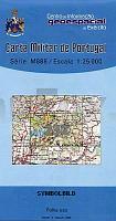
 | 232 - Topographische Landkarte Portugal 1:25.000 Carta Militar de Portugal - Série M888 Instituto Geográfico do Exército (IGeoE) - Portugal |
 | Erläuterungen zur Geologischen Karte 5041 Langenleuba (75) - Ausgabe 1879 Sächsisches Landesamt für Umwelt, Landwirtschaft und Geologie |
| 364.2 Amtliche topographische Karte 1:50.000 Polen |
| 3647-SW Topographische Karte 1:10.000 - Landesvermessungsamt Brandenburg |
 | 11-244 Topographische Karte 1:25.000 der Tschechischen Republik Zakladnà mapa Ceská republika Cesky urad zememericky a katastralni - ProjektNord |
 | P3431 Vörå Topographische Karte 1:25.000 EUREF (Peruskartta) Maanmittauslaitos / Lantmäteriverket Finnland - ProjektNord |
| 434.43 Amtliche topographische Karte 1:25.000 Polen |
 | Womosapiens (Band: 272) Geschichten rund ums Wohnmobil und seine Bewohner - von Norbert Bobrich OutdoorHandbuch - Conrad-Stein-Verlag |
 | Argentinien Reiseführer (engl.) Argentina Country Guide Lonely Planet |
 | Manitoba Touristische Landkarte /StraÃenkarte Easy to Read Provincial Map GM Johnson |
 | N4113 Jäminkipohja Topographische Karte 1:25.000 EUREF (Peruskartta) Maanmittauslaitos / Lantmäteriverket Finnland - ProjektNord |
| 195.21 Amtliche topographische Karte 1:25.000 Polen |
 | 4449 Schipkau Topographische Karte 1:25.000 Landesvermessungsamt Brandenburg (gefaltet) |
 | Nord- und Mittelgriechenland Reiseführer Michael-Müller-Verlag - Reiseführer |
 | S-02 Sci Alpinismo in Val Chisone - Val Pellice e Val Germanasca 1:25.000 (extra wasser- und reiÃfest) Topographische Skitourenkarte 1:25.000 Fraternali Editore - Italien |
 | L3712 Ibbenbüren (geplottete Ausgabe) Amtliche topographische Karte 1:50.000 Landesvermessungsamt Nordrhein-Westfalen |
 | Wilde Wege Bayerischer Wald - GPS 50 Touren. Mit GPS-Daten - von Eva Krötz - Bergverlag Rother |
 | Wandererlebnis Nationalpark Schwarzwald 1:25.000 (Blatt 618) - Nationalparkregion Schwarzwald GmbH |
 | 7731 Mering Topographische Landkarte Bayern 1:25.000 - Normalausgabe - ProjektNord (geplottete Ausgabe) - Grundlage amtliche Topographische Karte Bayern DTK25 |
 | Algerien und Tunesien 1:1.7 Mio. Landkarte Reise-Know-How Verlag - world mapping project |