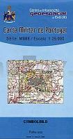
| << Portugal: Amtliche topografische Landkarten des Instituto Geográfico do Exército (IGeoE) 1:25.000 (Serie M888) |
||
|
||

Zuletzt angesehene Artikel:
 | 234 - Topographische Landkarte Portugal 1:25.000 Carta Militar de Portugal - Série M888 Instituto Geográfico do Exército (IGeoE) - Portugal |
 | 0244-2 RADA Topographische Landkarte 1:25.000 Spanien (Grundlage MTN25) Instituto Geográfico Nacional - CNIG Spanien - ProjektNord |
 | Wernigerode - Der Stadtführer Ein Führer durch die bunte Stadt am Harz - von Marion Schmidt Schmidt-Buch-Verlag |
 | L´Auvergne des Volcans - Michelin Editions des Voyages |
 | 920 (13-37) Costantina Amtliche topographische Landkarte 1:50.000 Spanien (M.T.N.) 920 Mapa Topográfico Nacional de Espana (MTN50) Instituto Geográfico Nacional - CNIG Spanien |
 | 0441-3 HÃJAR Topographische Landkarte 1:25.000 Spanien (Grundlage MTN25) Instituto Geográfico Nacional - CNIG Spanien - ProjektNord |
 | 134 Polientes Amtliche topographische Landkarte 1:50.000 Spanien (M.T.N.) 134 Mapa Topográfico Nacional de Espana (MTN50) Instituto Geográfico Nacional - CNIG Spanien |
 | 2946-SO Topographische Karte 1:10.000 - Landesvermessungsamt Brandenburg |
 | 898 (12-36) Puebla del Maestre Amtliche topographische Landkarte 1:50.000 Spanien (M.T.N.) 898 Mapa Topográfico Nacional de Espana (MTN50) Instituto Geográfico Nacional - CNIG Spanien |
 | 0459-1 EL CARDOSO DE LA SIERRA Topographische Landkarte 1:25.000 Spanien (Grundlage MTN25) Instituto Geográfico Nacional - CNIG Spanien - ProjektNord |
 | 280 Topographische Landkarte Wanderkarte und Fahrradkarte Portugal 1:25.000 280 Mapa topográfico - Mapa de caminhadas - Portugal 1:25.000 ProjektNord |
 | 360 Topographische Landkarte Wanderkarte und Fahrradkarte Portugal 1:25.000 360 Mapa topográfico - Mapa de caminhadas - Portugal 1:25.000 ProjektNord |
 | 314-3 CILLERUELO DE ABAJO Amtliche topographische Landkarte 1:25.000 Spanien (M.T.N.) 314-3 Mapa Topográfico Nacional de Espana (MTN25) Instituto Geográfico Nacional - CNIG Spanien |
 | 461-3 Baides Amtliche topographische Landkarte 1:25.000 Spanien (M.T.N.) 461-3 Mapa Topográfico Nacional de Espana (MTN25) Instituto Geográfico Nacional - CNIG Spanien |
 | 550-4 ROBLEDA Amtliche topographische Landkarte 1:25.000 Spanien (M.T.N.) 550-4 Mapa Topográfico Nacional de Espana (MTN25) Instituto Geográfico Nacional - CNIG Spanien |
 | 431-4 VILLAREJO Amtliche topographische Landkarte 1:25.000 Spanien (M.T.N.) 431-4 Mapa Topográfico Nacional de Espana (MTN25) Instituto Geográfico Nacional - CNIG Spanien |
 | 0046-2 CAMBÃS Topographische Landkarte 1:25.000 Spanien (Grundlage MTN25) Instituto Geográfico Nacional - CNIG Spanien - ProjektNord |
 | 512-3 HENCHE Amtliche topographische Landkarte 1:25.000 Spanien (M.T.N.) 512-3 Mapa Topográfico Nacional de Espana (MTN25) Instituto Geográfico Nacional - CNIG Spanien |
 | 178-IV Puyarruego Amtliche topographische Landkarte 1:25.000 Spanien (M.T.N.) 178-IV Mapa Topográfico Nacional de Espana (MTN25) Instituto Geográfico Nacional - CNIG Spanien |
| NM 33-11-12 (4312) Retz Ãsterreichische Karte 1:50.000 mit Wegmarkierungen (topographische Wanderkarte - UTM) - BEV - Ãsterreich |