
| << Portugal: Amtliche topografische Landkarten des Instituto Geográfico do Exército (IGeoE) 1:25.000 (Serie M888) |
||
|
||


Zuletzt angesehene Artikel:
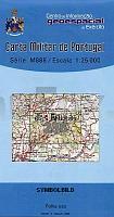
 | 236 - Topographische Landkarte Portugal 1:25.000 Carta Militar de Portugal - Série M888 Instituto Geográfico do Exército (IGeoE) - Portugal |
 | Saybuscher Beskiden Landkarte 1:50.000 Touristische Landkarte/Radwanderkarte - Polen Beskid Żywiecki mapa ExpressMap - Polen |
 | 0149-3 SALARDÚ Topographische Landkarte 1:25.000 Spanien (Grundlage MTN25) Instituto Geográfico Nacional - CNIG Spanien - ProjektNord |
 | Plan-Mappe Nr. 1: Kreis Aachen Stadtplan von Stadt Aachen, Alsdorf, Baesweiler, Eschweiler, Herzogenrath, Monschau, Roetgen, Simmerath, Stolberg, Würselen und Kreiskarte Blees-Verlag |
 | 287-2 SALAS ALTAS Amtliche topographische Landkarte 1:25.000 Spanien (M.T.N.) 287-2 Mapa Topográfico Nacional de Espana (MTN25) Instituto Geográfico Nacional - CNIG Spanien |
 | MARCO POLO Länderkarte Spanien - Portugal - Andorra 1:1 Mio. Touristische Landkarte - MARCO POLO |
 | 6-4 Montalegre Topographische Landkarte Portugal 1:50.000 Carta Militar de Portugal Instituto Geográfico do Exército (IGeoE) - Portugal |
 | 3641 Brandanburg a.d. Havel - Göttin Topographische Karte 1:25.000 Landesvermessungsamt Brandenburg (gefaltet) |
 | 0361-2 TORÀ Topographische Landkarte 1:25.000 Spanien (Grundlage MTN25) Instituto Geográfico Nacional - CNIG Spanien - ProjektNord |
 | 0458-1 PRÁDENA Topographische Landkarte 1:25.000 Spanien (Grundlage MTN25) Instituto Geográfico Nacional - CNIG Spanien - ProjektNord |
 | 0482-3 MUÑOPEDRO Topographische Landkarte 1:25.000 Spanien (Grundlage MTN25) Instituto Geográfico Nacional - CNIG Spanien - ProjektNord |
 | 0706 MADROÑERA Topographische Landkarte 1:50.000 Spanien (Grundlage MTN50) Instituto Geográfico Nacional - CNIG Spanien - ProjektNord |
 | U4434 Topographische Karte 1:25.000 EUREF (Peruskartta) Maanmittauslaitos / Lantmäteriverket Finnland - ProjektNord |
 | 0117-4 ISABA/IZABA Topographische Landkarte 1:25.000 Spanien (Grundlage MTN25) Instituto Geográfico Nacional - CNIG Spanien - ProjektNord |
 | 87 - Topographische Landkarte Portugal 1:25.000 Carta Militar de Portugal - Série M888 Instituto Geográfico do Exército (IGeoE) - Portugal |
 | Dormagen Topographische Wanderkarte Nordrhein-Westfalen mit Wanderwegen und Radwegen 1:25.000 - ProjektNord |
 | 96 - Topographische Landkarte Portugal 1:25.000 Carta Militar de Portugal - Série M888 Instituto Geográfico do Exército (IGeoE) - Portugal |
 | L3133 Korpoström Topographische Karte 1:25.000 EUREF (Peruskartta) Maanmittauslaitos / Lantmäteriverket Finnland - ProjektNord |
 | N-34-64-C/D Paslek Amtliche topographische Landkarte Polen 1:50.000 N-34-64-C/D Paslek - Mapa Topograficzna Polski Glowny Geodeta Kraju |
 | 2311-I-NØ Rudkøbing Topographische Karte Dänemark 1:25.000 Topografisk kort Danmark (DTK/Kort25) 2311-I-NØ ProjektNord - Kort & Matrikelstyrelsen / Geodætisk Institut |