| << Portugal: Amtliche topografische Landkarten des Instituto Geográfico do Exército (IGeoE) 1:25.000 (Serie M888) |
||
|
||

Zuletzt angesehene Artikel:
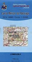
 | 255 - Topographische Landkarte Portugal 1:25.000 Carta Militar de Portugal - Série M888 Instituto Geográfico do Exército (IGeoE) - Portugal |
 | Biebrza-Nationalpark (englisch) 1:100.000 / 1:50.000 Touristische Landkarte und Wanderkarte Polen - Cartomedia |
 | Landkarten-Rätselreise Deutschland Mehr als 40 abwechslungsreiche Augenreisen durch die Heimat - von Ormo, Nadine - DuMont Reiseverlag |
 | 4354 Forst (Lausitz) - Groà Bademeusel Sonderausgabe mit Wanderwegen - Topographische Wanderkarte Brandenburg 1:25.000 ProjektNord |
 | New Plymouth & Taranaki Towns Minimap 17 Kiwimaps Ltd - Neuseeland |
 | British Columbia Südwest & Washington 1:800.000 Landkarte - ITMB International Travel Maps (engl.) British Columbia SW & Washington State |
 | 8130 Bidingen Topographische Landkarte Bayern 1:25.000 - Normalausgabe - ProjektNord (geplottete Ausgabe) - Grundlage amtliche Topographische Karte Bayern DTK25 |
 | L-34-19-D Hajduszoboszlo Amtliche Topographische Karte Ungarn 1:50.000 |
 | 3438 Jerichow Topographische Karte 1:25.000 Landesvermessungsamt Brandenburg (gefaltet) |
| 4151-SO Topographische Karte 1:10.000 - Landesvermessungsamt Brandenburg |
 | X5123 Topographische Karte 1:25.000 EUREF (Peruskartta) Maanmittauslaitos / Lantmäteriverket Finnland - ProjektNord |
| Michigan - Saginaw Valley regionale StraÃenkarte 1:144.000 (Michigan - USA) Michigan - Saginaw Valley regional map GM Johnson |
| Maui Dive Map Mini Hawaiian Fish Card - Franko Maps (engl.) |
 | Wallis Trescher-Verlag |
 | Traversée de l`Aude - Pays Cathare - GR36 + 36A + 10 jours de randonnée - Réf. 0360 Topographischer Wanderführer - FFRP (Fédération française de randonnée pédestre) Frankreich |
 | N6222 Petkeljärvi Topographische Karte 1:25.000 EUREF (Peruskartta) Maanmittauslaitos / Lantmäteriverket Finnland - ProjektNord |
 | Territori Cerdanya 360 1:40.000 Wanderkarte Spanien - ALPINA |
 | 6230 Höchstadt an der Aisch Topographische Landkarte Bayern 1:25.000 - Normalausgabe - ProjektNord (geplottete Ausgabe) - Grundlage amtliche Topographische Karte Bayern DTK25 |
 | 397 - Topographische Landkarte Portugal 1:25.000 Carta Militar de Portugal - Série M888 Instituto Geográfico do Exército (IGeoE) - Portugal |
 | Ulm CityTrip - von Markus Bingel - Reise Know-How |