| << Portugal: Amtliche topografische Landkarten des Instituto Geográfico do Exército (IGeoE) 1:25.000 (Serie M888) |
||
|
||

Zuletzt angesehene Artikel:
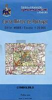
 | 262 - Topographische Landkarte Portugal 1:25.000 Carta Militar de Portugal - Série M888 Instituto Geográfico do Exército (IGeoE) - Portugal |
 | Amorgos (Blatt 10.27) Topografische Wanderkarte griechische Inseln - Ãgäis - Kykladen - 1:32.000 - Aegean Cyclades - Anavasi - Griechenland Αμοργος - Amorgos - ΠΕΖΟΠΟΡΙΚΕΣ ΔΙΑΔΡΟΜΕΣ - Hiking Routes |
 | 97 Schlesische Beskiden und Jablunkau Wanderkarte Tschechien 1:50.000 - KCT - Papierausgabe 97 Slezské Beskydy a Jablunkovsko |
 | N5313 Kerimäki Topographische Karte 1:25.000 EUREF (Peruskartta) Maanmittauslaitos / Lantmäteriverket Finnland - ProjektNord |
 | Rund um Soest Topographische Wanderkarte Nordrhein-Westfalen mit Wanderwegen und Radwegen 1:25.000 - ProjektNord |
 | Südschwarzwald-Radweg bikeline Radwanderführer - Esterbauer |