| << Portugal: Amtliche topografische Landkarten des Instituto Geográfico do Exército (IGeoE) 1:25.000 (Serie M888) |
||
|
||

Zuletzt angesehene Artikel:
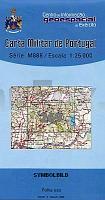
 | 269 - Topographische Landkarte Portugal 1:25.000 Carta Militar de Portugal - Série M888 Instituto Geográfico do Exército (IGeoE) - Portugal |
 | 968 Alcaudete Amtliche topographische Landkarte 1:50.000 Spanien (M.T.N.) 968 Mapa Topográfico Nacional de Espana (MTN50) Instituto Geográfico Nacional - CNIG Spanien |
 | 796 Gandia Amtliche topographische Landkarte 1:50.000 Spanien (M.T.N.) 796 Mapa Topográfico Nacional de Espana (MTN50) Instituto Geográfico Nacional - CNIG Spanien |
 | C6730 Nürnberg Topographische Karte 1:100.000 - ProjektNord - Kartographie Bayrisches Landesvermessungsamt |
 | 2214-II-Sà Topographische Karte Dänemark 1:25.000 Topografisk kort Danmark (DTK/Kort25) 2214-II-Sà ProjektNord - Kort & Matrikelstyrelsen / Geodætisk Institut |
 | Day Walks on the High Weald Vertebrate Publishing |
| 3447-SO Topographische Karte 1:10.000 - Landesvermessungsamt Brandenburg |
 | 0752 MIRANDILLA Topographische Landkarte 1:50.000 Spanien (Grundlage MTN50) Instituto Geográfico Nacional - CNIG Spanien - ProjektNord |
 | 0683 LOS NAVALUCILLOS Topographische Landkarte 1:50.000 Spanien (Grundlage MTN50) Instituto Geográfico Nacional - CNIG Spanien - ProjektNord |
| 2646-SO Topographische Karte 1:10.000 - Landesvermessungsamt Brandenburg |
 | 296 Marinha Grande Topographische Landkarte Wanderkarte und Fahrradkarte Portugal 1:25.000 296 Mapa topográfico - Mapa de caminhadas - Portugal 1:25.000 ProjektNord |
 | 2011 08 Hanko Topographische Karte 1:20.000 (Maastokartta / Peruskartta / Grundkarta) Maanmittauslaitos / Lantmäteriverket Finnland - ProjektNord |
| 3543-SO Topographische Karte 1:10.000 - Landesvermessungsamt Brandenburg |
 | 6: Luxemburg - Gaume- Ardennen Wanderkarte 1:85.000 GR Luxemburg - Gaume - Ardennen wandelkaart Alta Via - Belgien |
 | 233 Valencia de Don Juán Amtliche topographische Landkarte 1:50.000 Spanien (M.T.N.) 233 Mapa Topográfico Nacional de Espana (MTN50) Instituto Geográfico Nacional - CNIG Spanien |
 | 6011 Simmern (Hunsrück) - Wanderkarte mit Wanderwegen (geplottete Ausgabe) ProjektNord - Grundlage Amtliche topographische Karte Landesamt für Vermessung und Geobasisinformation Rheinland-Pfalz |
| 3948-SO Topographische Karte 1:10.000 - Landesvermessungsamt Brandenburg |
 | 892 Amtliche topographische Landkarte 1:50.000 Spanien (M.T.N.) 892 Mapa Topográfico Nacional de Espana (MTN50) Instituto Geográfico Nacional - CNIG Spanien |
 | 0348 SAN LEONARDO DE YAGÃE Topographische Landkarte 1:50.000 Spanien (Grundlage MTN50) Instituto Geográfico Nacional - CNIG Spanien - ProjektNord |
 | 3412 08 Sipola Topographische Karte 1:20.000 (Maastokartta / Peruskartta / Grundkarta) Maanmittauslaitos / Lantmäteriverket Finnland - ProjektNord |