| << Portugal: Amtliche topografische Landkarten des Instituto Geográfico do Exército (IGeoE) 1:25.000 (Serie M888) |
||
|
||

Zuletzt angesehene Artikel:
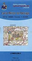
 | 277 - Topographische Landkarte Portugal 1:25.000 Carta Militar de Portugal - Série M888 Instituto Geográfico do Exército (IGeoE) - Portugal |
 | Finale Ligure 1:8.000 Trekking Liguria Outdoor Finale Ligure trekking. Carta dei sentieri - Sentieri e passeggiate di Liguria EdM - Edizioni del Magistero - Italien |
 | 809-3 VALDEAZOGUES Amtliche topographische Landkarte 1:25.000 Spanien (M.T.N.) 809-3 Mapa Topográfico Nacional de Espana (MTN25) Instituto Geográfico Nacional - CNIG Spanien |
 | West-Finnland GT 1:250.000 Utflyktskarta - Outdoorkarte - Freizeitkarte - Fahrradkarte Länsi-Suomi Retkeily GT Karttakeskus / Genimap Finnland |
 | 381 Monte Rosa 1:25.000 - Alte valli di Ayas e di Gressoney - Wanderkarte 4land Carta Topografica Escursionistica 4land |
 | 18 - Topographische Landkarte Portugal 1:25.000 Carta Militar de Portugal - Série M888 Instituto Geográfico do Exército (IGeoE) - Portugal |
 | S4343 Livo Topographische Karte 1:25.000 EUREF (Peruskartta) Maanmittauslaitos / Lantmäteriverket Finnland - ProjektNord |
 | 105B13 - Caribou Lakes Topographische Landkarte 1:50.000 - Canada - Yukon |
 | 0455 ARÃVALO Topographische Landkarte 1:50.000 Spanien (Grundlage MTN50) Instituto Geográfico Nacional - CNIG Spanien - ProjektNord |
 | CC 3102 Emden Bodenübersichtskarte 1:200.000 - Bundesanstalt für Geowissenschaften und Rohstoffe (BGR) |
 | Parco dell`Aveto Foglio Est e Sud - Provincia di Genova 1:25.000 (Blatt GE-15) Carta dei Sentieri Topographische Wanderkarte EdM - Edizioni del Magistero - Italien |
| 4149-SO Topographische Karte 1:10.000 - Landesvermessungsamt Brandenburg |
 | Bijsk Stadtplan 1:25.000 - Russland Biysk |
 | 0808-1 ALMADÃN Topographische Landkarte 1:25.000 Spanien (Grundlage MTN25) Instituto Geográfico Nacional - CNIG Spanien - ProjektNord |
 | 0247-4 LUPIÃÃN Topographische Landkarte 1:25.000 Spanien (Grundlage MTN25) Instituto Geográfico Nacional - CNIG Spanien - ProjektNord |
 | N5421 Ristinkylä Topographische Karte 1:25.000 EUREF (Peruskartta) Maanmittauslaitos / Lantmäteriverket Finnland - ProjektNord |
 | 909 Nerpio Amtliche topographische Landkarte 1:50.000 Spanien (M.T.N.) 909 Mapa Topográfico Nacional de Espana (MTN50) Instituto Geográfico Nacional - CNIG Spanien |
 | C7130 WeiÃenburg in Bayern Topographische Karte 1:100.000 - ProjektNord - Kartographie Bayrisches Landesvermessungsamt |
 | I13 Regensburg-Nord - Maxhütte-Haidhof - Laaber - Kallmünz - Lappersdorf - Nittendorf - Regenstauf *** SCHNÃPPCHEN *** ATK25 Topographische Karte 1:25.000 (Atkis) Bayern Landesvermessungsamt Bayern - Wanderkarte - Radwanderkarte |
 | Aasiaat 1:100.000 Wanderkarte Westgrönland - Vandrekort Vestgrønland Compukort / Greenland Tourism (Blatt 18) |