| << Portugal: Amtliche topografische Landkarten des Instituto Geográfico do Exército (IGeoE) 1:25.000 (Serie M888) |
||
|
||

Zuletzt angesehene Artikel:
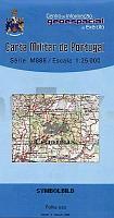
 | 294 - Topographische Landkarte Portugal 1:25.000 Carta Militar de Portugal - Série M888 Instituto Geográfico do Exército (IGeoE) - Portugal |
 | Monte Baldo (Nr. 129) Wanderkarte mit Radtouren. GPS-genau. 1:25.000 KOMPASS-Karten |
 | Menschen am Berg Geschichten vom Leben ganz oben - von Melanie Mühl - Malik National Geographic |
 | Augsburg - Westliche Wälder (Nr. 162) 1:50.000 - Wanderkarte 4in1 Wanderkarte mit Aktiv Guide und Detailkarten inklusive Karte zur offline Verwendung in der KOMPASS-App. Fahrradfahren. - von KOMPASS-Karten GmbH |
 | 04-312 Topographische Karte 1:25.000 der Tschechischen Republik Zakladnà mapa Ceská republika Cesky urad zememericky a katastralni - ProjektNord |
 | Radkarte Oberallgäu 1:65.000 wasserfest, reiÃfest laminiert - AVA Agrar-Verlag Allgäu |
 | U5243 Topographische Karte 1:25.000 EUREF (Peruskartta) Maanmittauslaitos / Lantmäteriverket Finnland - ProjektNord |
 | Kanada Mitte - Landkarte 1:2.1 Mio. (Blatt 3114) AdventureMap wasserfest Canada central National Geographic |
 | 4 South Downs - The New Forest & The Isle of Wight Cycle Map 1:100.000 Cycle Maps UK - Lovell Johns |
 | V514 Reututunturi Topographische Karte 1:50.000 EUREF-FIN (Maastokarttat) Maanmittauslaitos / Lantmäteriverket Finnland - ProjektNord |
 | T5322 Niitselysjoki Topographische Karte 1:25.000 EUREF (Peruskartta) Maanmittauslaitos / Lantmäteriverket Finnland - ProjektNord |
 | 6741 Cham West Topographische Landkarte Bayern 1:25.000 - Normalausgabe - ProjektNord (geplottete Ausgabe) - Grundlage amtliche Topographische Karte Bayern DTK25 |
 | Türkei StraÃenkarte - Touristische Landkarte 1:2.1 Mio. Türkiye turism ve karayolları haritası Gürbüz - Türkei |
 | Frankreich 1593 Historische Landkarte auf Pergament (Faksimile) - 50 x 37,5 cm - PLANO gerollt Antica |
 | M4213 Kangasala Topographische Karte 1:25.000 EUREF (Peruskartta) Maanmittauslaitos / Lantmäteriverket Finnland - ProjektNord |