| << Portugal: Amtliche topografische Landkarten des Instituto Geográfico do Exército (IGeoE) 1:25.000 (Serie M888) |
||
|
||

Zuletzt angesehene Artikel:
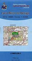
 | 303 - Topographische Landkarte Portugal 1:25.000 Carta Militar de Portugal - Série M888 Instituto Geográfico do Exército (IGeoE) - Portugal |
 | 5225 (NL 33-03-25) Fürstenfeld Topographische Wanderkarte 1:50.000 mit Wegmarkierungen - Ãsterreich - Kartographie BEV - ProjektNord |
 | T4314 Inginkivalo Topographische Karte 1:25.000 EUREF (Peruskartta) Maanmittauslaitos / Lantmäteriverket Finnland - ProjektNord |
 | 4326 (NM 33-11-26) Steyr Topographische Wanderkarte 1:50.000 mit Wegmarkierungen - Ãsterreich - Kartographie BEV - ProjektNord |
 | 18H NV GRANINGE 1:50.000 *** SCHNÃPPCHEN *** Topographische Wanderkarte Schweden (Terrängkarta/Gröna Kartan) - Kartförlaget - Lantmäteriet Landkarte Schweden |
 | 105B - Wolf Lake Topographische Landkarte 1:250.000 - Canada - Yukon |
 | Lingen (Ems) West Topographische Wanderkarte Niedersachsen mit Wanderwegen und Radwegen 1:25.000 - ProjektNord |
 | Naturpark Westhavelland Nord Topographische Wanderkarte mit Wanderwegen und Radwegen 1:50.000 - ProjektNord |
 | 4209 (NL 33-02-09) Hieflau Topographische Wanderkarte 1:50.000 mit Wegmarkierungen - Ãsterreich - Kartographie BEV - ProjektNord |
 | 3547 Berlin Köpenick Sonderausgabe mit Wanderwegen - Topographische Wanderkarte Brandenburg 1:25.000 ProjektNord |
| CC 6302 Trier (BÃK200) Bodenübersichtskarte 1:200.000 - Bundesanstalt für Geowissenschaften und Rohstoffe (BGR) |
 | N542 Joensuu Topographische Karte 1:50.000 EUREF-FIN (Maastokarttat) Maanmittauslaitos / Lantmäteriverket Finnland - ProjektNord |
 | 2841 Dossow Sonderausgabe mit Wanderwegen - Topographische Wanderkarte Brandenburg 1:25.000 ProjektNord |
 | Universal-Karte von DEUTSCHLAND 1937 Deutsches Reich mit Handel und Verkehr und Ortsverzeichnis inkl. Einwohnerzahl (Plano - 2 BLATT) Verlag Rockstuhl |
 | Nationalpark Hohe Tauern Süd 1:50.000 (Blatt 49) - Wanderkarte mit Broschüre *** SCHNÃPPCHEN *** KOMPASS |
 | 573 Santa Cruz (Almodovar) Topographische Landkarte Portugal 1:25.000 Carta Militar de Portugal - Série M888 Instituto Geográfico do Exército (IGeoE) - Portugal |
 | P5141 Muuruvesi Topographische Karte 1:25.000 EUREF (Peruskartta) Maanmittauslaitos / Lantmäteriverket Finnland - ProjektNord |
 | Schottland West & Inseln 1:250.000 Landkarte - ITMB International Travel Reference Maps (engl.) Western Scotland & Islands |
 | 3614 Wallenhorst Amtliche topographische Karte 1:25.000 Landesvermessungsamt Niedersachsen |
| Erläuterungen zur Geologischen Karte 4751 Kloster St. Marienstern (37) - Ausgabe 1890 Sächsisches Landesamt für Umwelt, Landwirtschaft und Geologie |