| << Portugal: Amtliche topografische Landkarten des Instituto Geográfico do Exército (IGeoE) 1:25.000 (Serie M888) |
||
|
||

Zuletzt angesehene Artikel:
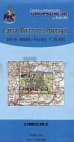
 | 320 - Topographische Landkarte Portugal 1:25.000 Carta Militar de Portugal - Série M888 Instituto Geográfico do Exército (IGeoE) - Portugal |
 | Warna mit Albena, Goldstrand und Heiliger Konstantin Stadtplan 1:10.000 (englisch und deutsch) Domino Bulgarien |
 | BG35 Topographische Landkarte Neuseeland 1:50.000 Land Information New Zealand |
 | 49 Saarer Höhen Wanderkarte Tschechien 1:50.000 Zdárské vrchy - SHOCart |
 | 042 Glen Garry & Loch Rannoch - Wanderkarte GroÃbritannien 1:50.000 Active Laminiert LANDRANGER MAP - Ordnance Survey |
 | Andalucian Coast to Coast walk from the Mediterrean to the Atlantic Wanderführer - Cicerone (englisch) |
 | Scandinavian Mountains and Peaks Over 2000 Metres in the Hurrungane Walks, Scrambles, Climbs and Ski Tours in Scandinavia`s Most Spectacular Mountains - SCANDINAVIAN PUBLISHING |
 | Venetien Reisehandbuch - Michael-Müller-Verlag - Reiseführer |
 | 25 Hornafjördur Atlaskort - Topographische Landkarte Island 1:100.000 Hornafjörður Forlagid - Mál og menning - Island |
 | 25 Braunau - Adersbach Wanderkarte Tschechien 1:50.000 Broumovsko, Adrspach - SHOCart |
 | DUMONT Reise-Handbuch Norwegen von Möbius, Michael u. Ster, Annette |
| Sevilla Stadtplan 1:17.000 FLORENCE - Internationale Stadtpläne Cartographia |
| 233.31 Amtliche topographische Karte 1:25.000 Polen |
 | Graubünden Panoramakarte Schweiz Hallwag Verlag |
 | 45 Neuhaus - Böhmisch Kanada Wanderkarte Tschechien 1:50.000 Jindrichohradecko - Ceska Kanada - SHOCart |
 | DUMONT Reise-Taschenbuch Amsterdam von Völler, Susanne u. Winterling, Anne |
 | Enns-Radweg 1:100.000 Von der Quelle zur Donau - bikeline Radwanderführer - Esterbauer |
 | Peloponnes Reisehandbuch - Michael-Müller-Verlag - Reiseführer |
 | Georgien ein Länderporträt - von Dieter Boden - Ch. Links Verlag |
 | 145 Guildford & Farnham - Wanderkarte GroÃbritannien 1:25.000 EXPLORER MAP - Ordnance Survey |