| << Portugal: Amtliche topografische Landkarten des Instituto Geográfico do Exército (IGeoE) 1:25.000 (Serie M888) |
||
|
||

Zuletzt angesehene Artikel:
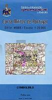
 | 336 Santo Antonio das Areias (Marvao) Topographische Landkarte Portugal 1:25.000 Carta Militar de Portugal - Série M888 Instituto Geográfico do Exército (IGeoE) - Portugal |
 | 2143 01 Padankoski Topographische Karte 1:20.000 (Maastokartta / Peruskartta / Grundkarta) Maanmittauslaitos / Lantmäteriverket Finnland - ProjektNord |
 | 3243 02 Leppävirta Topographische Karte 1:20.000 (Maastokartta / Peruskartta / Grundkarta) Maanmittauslaitos / Lantmäteriverket Finnland - ProjektNord |
 | 2318-II Frederikshavn - mit Wanderwegen und Fahrradrouten Topographische Fahrradkarte und Wanderkarte Dänemark 1:50.000 - Kort & Matrikelstyrelsen ProjektNord 2318-II Frederikshavn - Topografisk Cykel- og Vandrekort Danmark |
 | 6833 Hilpoltstein Topographische Landkarte Bayern 1:25.000 - Normalausgabe - ProjektNord (geplottete Ausgabe) - Grundlage amtliche Topographische Karte Bayern DTK25 |
 | Erläuterungen zur Geologischen Karte 5055 Hirschfelde (89/90/108) - Ausgabe 1937 Sächsisches Landesamt für Umwelt, Landwirtschaft und Geologie |
 | Oblast Kostroma 1:500.000 StraÃenkarte / Regionalkarte - Russland Костромская область Rus Co. Ltd. |
| 4451 Jessen (Kreis Spremberg) - Geologische Karte 1:25.000 (GK25) Grundlage Messtischblatttopographie Sächsisches Landesamt für Umwelt, Landwirtschaft und Geologie |
| 3173 Bartschin Topographische Karte 1:25.000 Messtischblatt des Deutschen Reiches - PreuÃische Landesaufnahme / Reichsamt für Landesaufnahme - Faksimile ProjektNord |
 | 4110 Senden - Wanderkarte mit Wanderwegen (geplottete Ausgabe) ProjektNord - Grundlage Amtliche topographische Karte 1:25.000 Landesvermessungsamt Nordrhein-Westfalen |
 | 2634 02 Airiselkä Topographische Karte 1:20.000 (Maastokartta / Peruskartta / Grundkarta) Maanmittauslaitos / Lantmäteriverket Finnland - ProjektNord |
| 5140 Meerane-Crimmitschau (93) - Geologische Karte 1:25.000 (GK25) Grundlage Vollbornsche Ãquidistantenkarte Sächsisches Landesamt für Umwelt, Landwirtschaft und Geologie |
 | 2011 03+15 Hitis Topographische Karte 1:20.000 (Maastokartta / Peruskartta / Grundkarta) Maanmittauslaitos / Lantmäteriverket Finnland - ProjektNord |
| 1225/26 Gelting/Oehe - Gestern und Heute - Historische Ãberlagerung 1878-1880 Topographische Landkarte 1:25.000 im Vergleich - Landesvermessungsamt Schleswig-Holstein / ProjektNord |
 | Atlas der unteren Wolga 1:100.000 (Hardcover) Von Wolgograd bis Astrachan unsd zum Kaspischen Meer - Für Fischer, Jäger, Wanderer Атлас Нижней Волги Izdatelstvo Arbalet |