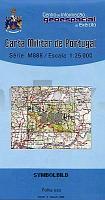
| << Portugal: Amtliche topografische Landkarten des Instituto Geográfico do Exército (IGeoE) 1:25.000 (Serie M888) |
||
|
||

Zuletzt angesehene Artikel:
 | 339 - Rio Maior - Topographische Landkarte Portugal 1:25.000 Carta Militar de Portugal - Série M888 Instituto Geográfico do Exército (IGeoE) - Portugal RIO MAIOR |
 | U5422 Topographische Karte 1:25.000 EUREF (Peruskartta) Maanmittauslaitos / Lantmäteriverket Finnland - ProjektNord |
 | U5141 Savukoski Topographische Karte 1:25.000 EUREF (Peruskartta) Maanmittauslaitos / Lantmäteriverket Finnland - ProjektNord |
 | Island Nordost StraÃenkarte *** SCHNÃPPCHEN *** Generalkarte 1:300.000 Island Mál og menning |
 | 3643 Werder (Havel) Sonderausgabe mit Wanderwegen - Topographische Wanderkarte Brandenburg 1:25.000 ProjektNord |
 | Nuuk 1:75.000 Wanderkarte Westgrönland - Vandrekort Vestgrønland Greenland Tourism (Blatt 11) |
 | Monte Amiata 1:25.000 (MA) - Topographische Wanderkarte - Italien - Club Alpino Italiano CAI Carta escursionistica del Monte Amiata MAPTREK Italia |
 | N5141 Rantasalmi Topographische Karte 1:25.000 EUREF (Peruskartta) Maanmittauslaitos / Lantmäteriverket Finnland - ProjektNord |
 | Q5142 Talvivaara Topographische Karte 1:25.000 EUREF (Peruskartta) Maanmittauslaitos / Lantmäteriverket Finnland - ProjektNord |
 | 0243-3 ARNEDO Topographische Landkarte 1:25.000 Spanien (Grundlage MTN25) Instituto Geográfico Nacional - CNIG Spanien - ProjektNord |
 | 181 - Topographische Landkarte Portugal 1:25.000 Carta Militar de Portugal - Série M888 Instituto Geográfico do Exército (IGeoE) - Portugal |
 | L3726 Peine (geplottete Ausgabe) Topographische Karte 1:50.000 Kartografie Landesvermessungsamt Niedersachsen - ProjektNord |
 | Parco del Beigua - Arenzano - Cogoleto - e Varazze - Provincia di Savona (Blatt SV-1) Topographische Wanderkarte 1:25.000 Carta dei Sentieri EdM - Edizioni del Magistero - Italien |
 | 595 Silves Topographische Landkarte Portugal 1:25.000 Carta Militar de Portugal - Série M888 Instituto Geográfico do Exército (IGeoE) - Portugal |
 | 2549 Göritz Sonderausgabe mit Wanderwegen - Topographische Wanderkarte Brandenburg 1:25.000 ProjektNord |
 | 5 Topographische Landkarte Wanderkarte und Fahrradkarte Portugal 1:25.000 005 Mapa topográfico - Mapa de caminhadas - Portugal 1:25.000 ProjektNord |
 | 21 Topographische Landkarte Wanderkarte und Fahrradkarte Portugal 1:25.000 021 Mapa topográfico - Mapa de caminhadas - Portugal 1:25.000 ProjektNord |
 | 3450 Müncheberg Sonderausgabe mit Wanderwegen - Topographische Wanderkarte Brandenburg 1:25.000 ProjektNord |
 | 2317-I - mit Wanderwegen und Fahrradrouten Topographische Fahrradkarte und Wanderkarte Dänemark 1:50.000 - Kort & Matrikelstyrelsen ProjektNord 2317-I - Topografisk Cykel- og Vandrekort Danmark |
 | 2746 Lychen - Beenz Sonderausgabe mit Wanderwegen - Topographische Wanderkarte Brandenburg 1:25.000 ProjektNord |