Willkommen bei MapFox
+++ Buchhändleranfragen willkommen! Tel. 0431-666 75 99 +++
Warenkorb
Artikel: 0 - € 0.00
Zur Kasse
Impressum Kontakt Versandkosten AGB
348 Marvao Topographische Landkarte Portugal 1:25.000 Carta Militar de Portugal - Série M888 Instituto Geográfico do Exército (IGeoE) - Portugal
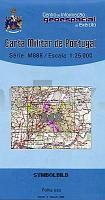
<< Portugal: Amtliche topografische Landkarten des Instituto Geográfico do Exército (IGeoE) 1:25.000 (Serie M888)
 
Cover

Gesamtliste mit Blattübersicht

Kartenausschnitt

348 Marvao Topographische Landkarte Portugal 1:25.000 Carta Militar de Portugal - Série M888 Instituto Geográfico do Exército (IGeoE) - Portugal
EAN / ISBN: 9789727652488
Preis: EUR 17.90

Bestellartikel: versandfertig in ca. 2 Wochen oder länger. Dieser Artikel wird speziell für Sie bestellt. Keine Rücknahme!
Produkt EUR Anzahl Bestellen
348 Marvao Topographische Landkarte Portugal 1:25.000 Carta Militar de Portugal - Série M888 Instituto Geográfico do Exército (IGeoE) - Portugal 17.90
Versandkostenfrei in Deutschland ab 30,- Bestellwert

incl. MwSt.

Stichworte, die bei der Suche nützlich sein könnten:
Marvao - Portugal - topografische Wanderkarten - Serie M888 - Série M888 - M888

Zuletzt angesehene Artikel:

Cover348 Marvao Topographische Landkarte Portugal 1:25.000 Carta Militar de Portugal - Série M888 Instituto Geográfico do Exército (IGeoE) - Portugal

CoverL3928 Salzgitter (geplottete Ausgabe) Topographische Karte 1:50.000 Kartografie Landesvermessungsamt Niedersachsen - ProjektNord

Noch kein Cover vorhanden3552-SO Topographische Karte 1:10.000 - Landesvermessungsamt Brandenburg

Cover3347 Bernau bei Berlin Sonderausgabe mit Wanderwegen - Topographische Wanderkarte Brandenburg 1:25.000 ProjektNord

Cover3141 Wildberg Sonderausgabe mit Wanderwegen - Topographische Wanderkarte Brandenburg 1:25.000 ProjektNord

CoverL3526 Burgdorf (geplottete Ausgabe) Topographische Karte 1:50.000 Kartografie Landesvermessungsamt Niedersachsen - ProjektNord

CoverWladimir - Wladimirer Oblast Stadtatlas und Straßenatlas 1:25.000 / 1:200.000
Wladimir - Wladimirskaja Oblast Rus Co. Ltd. - Russland

CoverKaiserwinkl - Walchensee - Kössen - Schwendt - Rettenschöss (Blatt 460) - Wanderkarte Walter Mayr - KOMPASS

Cover3744 Wildenbruch Sonderausgabe mit Wanderwegen - Topographische Wanderkarte Brandenburg 1:25.000 ProjektNord

Cover2846 Templin - Gandenitz Sonderausgabe mit Wanderwegen - Topographische Wanderkarte Brandenburg 1:25.000 ProjektNord

CoverW5112 Inari Topographische Karte 1:25.000 EUREF (Peruskartta) Maanmittauslaitos / Lantmäteriverket Finnland - ProjektNord

CoverNiederbergisches Land - Elfringhauser Schweiz Topographische Wanderkarte Nordrhein-Westfalen mit Wanderwegen und Radwegen 1:25.000 - ProjektNord

Cover2840 Wittstock/Dosse Sonderausgabe mit Wanderwegen - Topographische Wanderkarte Brandenburg 1:25.000 ProjektNord

Cover321 Alonissos 1:25.000 Landkarte Griechische Inseln -Terrain Cartography - Griechenland (wasserfest und reissfest) Terrain maps

Cover2745 Lychen Sonderausgabe mit Wanderwegen - Topographische Wanderkarte Brandenburg 1:25.000 ProjektNord

Cover3845 Woltersdorf Sonderausgabe mit Wanderwegen - Topographische Wanderkarte Brandenburg 1:25.000 ProjektNord

Cover21 Ouarzazate - Taliouine - Agdz - Foum Zguid Topographische Straßenkarte 1:250.000 - Marokko ProjektNord

Cover3348 Werneuchen Sonderausgabe mit Wanderwegen - Topographische Wanderkarte Brandenburg 1:25.000 ProjektNord

Cover6125 Würzburg Nord Topographische Landkarte Bayern 1:25.000 - Normalausgabe - ProjektNord (geplottete Ausgabe) - Grundlage amtliche Topographische Karte Bayern DTK25

CoverDie Erde politisch 1:60 Mio. mit Flaggen (53 x 68 cm) *** SCHNÄPPCHEN *** WANDKARTE mit Metallleisten - Craenen BVBA (englisch)