| << Portugal: Amtliche topografische Landkarten des Instituto Geográfico do Exército (IGeoE) 1:25.000 (Serie M888) |
  | |
|
||
Zuletzt angesehene Artikel:
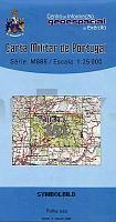
![]() | 351 - Topographische Landkarte Portugal 1:25.000 Carta Militar de Portugal - Série M888 Instituto Geográfico do Exército (IGeoE) - Portugal |
![]() | 0966 MONTILLA Topographische Landkarte 1:50.000 Spanien (Grundlage MTN50) Instituto Geográfico Nacional - CNIG Spanien - ProjektNord |
![]() | 0839-2 ALMEDINA Topographische Landkarte 1:25.000 Spanien (Grundlage MTN25) Instituto Geográfico Nacional - CNIG Spanien - ProjektNord |
![]() | 14: Deutschschland: Eifel - Mosel - Fahrradkarte 1:75.000 14: Germany: Eifel - Mosel fietskaart Alta Via - Frankreich |
![]() | 18W TER APEL (West) Topographische Karte der Niederlande 1:50.000 Topografische Dienst (Plotausgabe) |
![]() | 28 II Castelo de Vide - Topographische Landkarte Portugal 1:50.000 Carta Militar de Portugal Instituto Geográfico do Exército (IGeoE) - Portugal |
![]() | 0130-2 LA ERCINA Topographische Landkarte 1:25.000 Spanien (Grundlage MTN25) Instituto Geográfico Nacional - CNIG Spanien - ProjektNord |
![]() | 123-1 MONTERROSO Amtliche topographische Landkarte 1:25.000 Spanien (M.T.N.) 123-1 Mapa Topográfico Nacional de Espana (MTN25) Instituto Geográfico Nacional - CNIG Spanien |
![]() | 21-23, 21-14 Domazlice Topographische Karte 1:50.000 der Tschechischen Republik Zakladní mapa Ceská republika - Cesky urad zememericky a katastralni - ProjektNord |
![]() | 0244-3 ALFARO Topographische Landkarte 1:25.000 Spanien (Grundlage MTN25) Instituto Geográfico Nacional - CNIG Spanien - ProjektNord |
![]() | Suffolk Fahrradkarte 1:126.720 Cycling maps - country lanes & byways (waterproof) Suffolk cycling map Goldeneye Publications - Großbritannien |
![]() | T5111 Auttijärvi Topographische Karte 1:25.000 EUREF (Peruskartta) Maanmittauslaitos / Lantmäteriverket Finnland - ProjektNord |
![]() | 0964-1 EL ACEBUCHAL Topographische Landkarte 1:25.000 Spanien (Grundlage MTN25) Instituto Geográfico Nacional - CNIG Spanien - ProjektNord |
![]() | 12: Huy - Marche-en-Famenne - Dinant - Rochefort - Topographische Karte 1:100.000 Kartographie NGI Belgien / ProjektNord |
![]() | 115 Valpelline - Valle di Ollomont - Valle di St. Barthelemy - Topographische Wanderkarte 1:30.000 - IGC Italien |
![]() | 1048-2 GIBALBÍN Topographische Landkarte 1:25.000 Spanien (Grundlage MTN25) Instituto Geográfico Nacional - CNIG Spanien - ProjektNord |
![]() | Overberg Whale Coast - Hermanus - Cape Agulhas - Swellendam topographische Straßenkarte 1:250.000 / regionale Wanderkarten 1:25.000 slingsby´s |
![]() | 591-4 RUBIELOS DE MORA Amtliche topographische Landkarte 1:25.000 Spanien (M.T.N.) 591-4 Mapa Topográfico Nacional de Espana (MTN25) Instituto Geográfico Nacional - CNIG Spanien |
![]() | M5441 Saari Topographische Karte 1:25.000 EUREF (Peruskartta) Maanmittauslaitos / Lantmäteriverket Finnland - ProjektNord |
![]() | 1029-2 GÉRGAL Topographische Landkarte 1:25.000 Spanien (Grundlage MTN25) Instituto Geográfico Nacional - CNIG Spanien - ProjektNord |


