| << Portugal: Amtliche topografische Landkarten des Instituto Geográfico do Exército (IGeoE) 1:25.000 (Serie M888) |
||
|
||

Zuletzt angesehene Artikel:
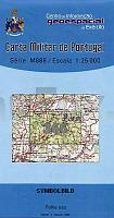
 | 366 - Topographische Landkarte Portugal 1:25.000 Carta Militar de Portugal - Série M888 Instituto Geográfico do Exército (IGeoE) - Portugal |
 | Hardangervidda nordost Topographische Wanderkarte Topo 3000 - 1:50.000 (Blatt 3057) - Nordeca - Norwegen Hardangervidda nordøst |
 | 512 Djúpini Färöer - Topographische Karte 1:20.000 512 Færøer - Topografisk kort 1:20.000 - Miliøministeriet - Kort & Matrikelstyrelsen / ProjektNord |
 | USA politisch - 3 Karten PLANO-Karte (Format: 280 x 194 cm) - gerollt im Plastikrohr USA political flat map 3-sheets National Geographic |
 | Tarn à pied PR 52 promenades & randonnées - Réf. D081 Topographischer Wanderführer - FFRP (Fédération française de randonnée pédestre) Frankreich |
 | Kanu Kompass - Südschweden - Das Reisehandbuch zum Kanuwandern Thomas Kettler u. Carola Hillmann - Thomas Kettler Verlag |
 | Türkische Riviera - Antalya, Side, Alanya 1:150.000 Autokarte Türk rivierasi - Antalya, Side, Alanya - Turkse riviera - Antalya, Side, Alanya freytag & berndt |
 | 4606 GT Ãle St-Martin - Ãle St-Barthélemy - Französische Antillen 1:25.000 Topographische Wanderkarte IGN (TOP25) Ãle St-Martin, Ãle St-Barthélemy, Guadeloupe |