| << Portugal: Amtliche topografische Landkarten des Instituto Geográfico do Exército (IGeoE) 1:25.000 (Serie M888) |
||
|
||

Zuletzt angesehene Artikel:
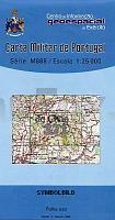
 | 371 - Topographische Landkarte Portugal 1:25.000 Carta Militar de Portugal - Série M888 Instituto Geográfico do Exército (IGeoE) - Portugal |
 | Schwarzwald mit Vogesen *** SCHNÃPPCHEN *** 40 Skitouren - Bergverlag Rother |
 | 0318 ALMARZA Topographische Landkarte 1:50.000 Spanien (Grundlage MTN50) Instituto Geográfico Nacional - CNIG Spanien - ProjektNord |
 | 305 - Topographische Landkarte Portugal 1:25.000 Carta Militar de Portugal - Série M888 Instituto Geográfico do Exército (IGeoE) - Portugal |
 | 2851 Groà Pinnow Sonderausgabe mit Wanderwegen - Topographische Wanderkarte Brandenburg 1:25.000 ProjektNord |
 | 4045-SO Topographische Karte 1:10.000 - Landesvermessungsamt Brandenburg |
 | 785 Almagro Amtliche topographische Landkarte 1:50.000 Spanien (M.T.N.) 785 Mapa Topográfico Nacional de Espana (MTN50) Instituto Geográfico Nacional - CNIG Spanien |
 | 874 Oliva de la Frontera Amtliche topographische Landkarte 1:50.000 Spanien (M.T.N.) 874 Mapa Topográfico Nacional de Espana (MTN50) Instituto Geográfico Nacional - CNIG Spanien |
 | 157 - Topographische Landkarte Portugal 1:25.000 Carta Militar de Portugal - Série M888 Instituto Geográfico do Exército (IGeoE) - Portugal |
 | 309 Ourém -Topographische Landkarte Portugal 1:25.000 Carta Militar de Portugal - Série M888 Instituto Geográfico do Exército (IGeoE) - Portugal |
| 3246-SO Topographische Karte 1:10.000 - Landesvermessungsamt Brandenburg |
 | 6012 Stromberg - Wanderkarte mit Wanderwegen (geplottete Ausgabe) ProjektNord - Grundlage Amtliche topographische Karte Landesamt für Vermessung und Geobasisinformation Rheinland-Pfalz |
 | Republik Altai Topografischer StraÃenatlas 1:200.000 Reskublika Altai - Atlas Avtodorog - Russland |
 | 3742 Damelang-Freienthal Sonderausgabe mit Wanderwegen - Topographische Wanderkarte Brandenburg 1:25.000 ProjektNord |
 | 599 Conceicao (Tavira) Topographische Landkarte Portugal 1:25.000 Carta Militar de Portugal - Série M888 Instituto Geográfico do Exército (IGeoE) - Portugal |
 | Tour pédestre du Pays du Mont-Blanc GRP Chamonix-Megève... *** SCHNÃPPCHEN *** - Réf. 0044 Topographischer Wanderführer - FFRP (Fédération française de randonnée pédestre) Frankreich |
 | 0175-1 MONASTERIO DE LEYRE Topographische Landkarte 1:25.000 Spanien (Grundlage MTN25) Instituto Geográfico Nacional - CNIG Spanien - ProjektNord |
 | 1000 Moguer Amtliche topographische Landkarte 1:50.000 Spanien (M.T.N.) 1000 Mapa Topográfico Nacional de Espana (MTN50) Instituto Geográfico Nacional - CNIG Spanien |
 | Bahnwanderweg Lötschberg In zehn Etappen von Frutigen nach Brig von Hans-Peter Bärtschi - Rotpunktverlag |
 | 216 Topographische Landkarte Wanderkarte und Fahrradkarte Portugal 1:25.000 216 Mapa topográfico - Mapa de caminhadas - Portugal 1:25.000 ProjektNord |