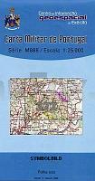
| << Portugal: Amtliche topografische Landkarten des Instituto Geográfico do Exército (IGeoE) 1:25.000 (Serie M888) |
||
|
||

Zuletzt angesehene Artikel:
 | 372 - Topographische Landkarte Portugal 1:25.000 Carta Militar de Portugal - Série M888 Instituto Geográfico do Exército (IGeoE) - Portugal |
 | 3673 Radlowo Topographische Karte 1:25.000 Messtischblatt des Deutschen Reiches - PreuÃische Landesaufnahme / Reichsamt für Landesaufnahme - Faksimile ProjektNord |
 | 2647 Fürstenwerder Sonderausgabe mit Wanderwegen - Topographische Wanderkarte Brandenburg 1:25.000 ProjektNord |
 | Carta dei Sentieri Canale del Brenta e Massiccio del Grappa (Nr. 4)- 2 Wanderkarten 1:25.000 mit Wanderführer Carta escursionistica Sezioni Vicentine del Club Alpino Italiano - Italien |
 | Forti di Genova - Genova - Golfo Paradiso - Via del sale (Blatt GE-1) Topographische Wanderkarte 1:25.000 Carta dei Sentieri Sentieri - Forti di Genova e Golfo Paradiso EdM - Edizioni del Magistero - Italien |
 | Le Dolomiti della Val di Lima 1:15.000 (DVL) - Wanderkarte Italien - MAPTREK - D.R.E.A.M. Italia |
 | Allenstein Kreiskarte des Deutschen Reiches 1:100.000 (KDR 100 KK) - Faksimile Reichsamt für Landesaufnahme |
 | Q5442 Korkana Topographische Karte 1:25.000 EUREF (Peruskartta) Maanmittauslaitos / Lantmäteriverket Finnland - ProjektNord |
 | Masuren - Das Land der groÃen Seen Touristische topographische Landkarte 1:75.000 (Blatt 280) - enthält ehem. deutsche Ortsnamen Mazury - Kraina Wielkich Jezior - Mapa turystyczna Top Mapa - Cartomedia - Polen |
 | 4351 Drebkau Sonderausgabe mit Wanderwegen - Topographische Wanderkarte Brandenburg 1:25.000 ProjektNord |
 | Q4234 Kangas Topographische Karte 1:25.000 EUREF (Peruskartta) Maanmittauslaitos / Lantmäteriverket Finnland - ProjektNord |
 | 0809-4 VIÃUELA Topographische Landkarte 1:25.000 Spanien (Grundlage MTN25) Instituto Geográfico Nacional - CNIG Spanien - ProjektNord |
 | 602 Lagos Topographische Landkarte Portugal 1:25.000 Carta Militar de Portugal - Série M888 Instituto Geográfico do Exército (IGeoE) - Portugal |
| L-34-32-A Berettyoujfalu Amtliche Topographische Karte Ungarn 1:50.000 |
 | Sisimiut 1:100.000 Wanderkarte Westgrönland - Vandrekort Vestgrønland Greenland Tourism (Blatt 10) |
 | La Porta del Cel 1:25.000 Wanderkarte Spanien - ALPINA |
 | 474 - Topographische Landkarte Portugal 1:25.000 Carta Militar de Portugal - Série M888 Instituto Geográfico do Exército (IGeoE) - Portugal |
 | N4211 Kurjenkylä Topographische Karte 1:25.000 EUREF (Peruskartta) Maanmittauslaitos / Lantmäteriverket Finnland - ProjektNord |
 | Mit dem Wohnmobil nach Thüringen (Band 9) *** SCHNÃPPCHEN *** Die Anleitung für einen Erlebnisurlaub. Tipps, Tricks, Touren, Tolle Plätze. Alle Plätze mit präzisen GPS-Daten - von Reinhard Schulz und Waltraud Roth-Schulz - WOMO-Verlag |
| L2546 Woldegk Topographische Karte 1:50.000 (Regelblattschnitt) Landesvermessungsamt Brandenburg |