| << Portugal: Amtliche topografische Landkarten des Instituto Geográfico do Exército (IGeoE) 1:25.000 (Serie M888) |
||
|
||

Zuletzt angesehene Artikel:
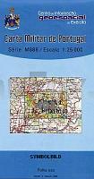
 | 403 - Topographische Landkarte Portugal 1:25.000 Carta Militar de Portugal - Série M888 Instituto Geográfico do Exército (IGeoE) - Portugal |
 | Q4314 Parkkima Topographische Karte 1:25.000 EUREF (Peruskartta) Maanmittauslaitos / Lantmäteriverket Finnland - ProjektNord |
 | 0484 BUITRAGO DEL LOZOYA Topographische Landkarte 1:50.000 Spanien (Grundlage MTN50) Instituto Geográfico Nacional - CNIG Spanien - ProjektNord |
 | Qeqertarsuatsiaat - Paamiut - Ivittuut 1:250.000 Topographische Landkarte (Grüne Serie) Saga Maps Grönland Fiskenæsset - Frederikshåb - Ivigtut |
 | 3223 (NL 33-01-23) Radstadt Topographische Wanderkarte 1:50.000 mit Wegmarkierungen - Ãsterreich - Kartographie BEV - ProjektNord |
 | Mulde - Eilenburg (Blatt 02) Topographische Wanderkarte 1:25.000 mit Wanderwegen - ProjektNord |
 | 3344 Bötzow Sonderausgabe mit Wanderwegen - Topographische Wanderkarte Brandenburg 1:25.000 ProjektNord |
 | Q5341 Jonkeri Topographische Karte 1:25.000 EUREF (Peruskartta) Maanmittauslaitos / Lantmäteriverket Finnland - ProjektNord |
 | Keski-Suomen kansallispuistot 1:25.000 Terrängkarta Wanderkarte Finnland - Calazo Förlag |
 | Barczew Topographische Karte 1:25.000 Messtischblatt des Deutschen Reiches - PreuÃische Landesaufnahme / Reichsamt für Landesaufnahme - Faksimile ProjektNord |
 | 3117 (NL 33-04-17) Nötsch im Gailtal Topographische Wanderkarte 1:50.000 mit Wegmarkierungen - Ãsterreich - Kartographie BEV - ProjektNord |
 | Q4222 Ulkokalla Topographische Karte 1:25.000 EUREF (Peruskartta) Maanmittauslaitos / Lantmäteriverket Finnland - ProjektNord |
 | Plowdiw - Sultan´s Trail - Topographische Reisekarte (Blatt 4) 1:250.000 Bulgarien Landkarte ProjektNord |
 | 149 - Topographische Landkarte Portugal 1:25.000 Carta Militar de Portugal - Série M888 Instituto Geográfico do Exército (IGeoE) - Portugal |
 | 303 - Topographische Landkarte Portugal 1:25.000 Carta Militar de Portugal - Série M888 Instituto Geográfico do Exército (IGeoE) - Portugal |
 | 5225 (NL 33-03-25) Fürstenfeld Topographische Wanderkarte 1:50.000 mit Wegmarkierungen - Ãsterreich - Kartographie BEV - ProjektNord |
 | T4314 Inginkivalo Topographische Karte 1:25.000 EUREF (Peruskartta) Maanmittauslaitos / Lantmäteriverket Finnland - ProjektNord |
 | 4326 (NM 33-11-26) Steyr Topographische Wanderkarte 1:50.000 mit Wegmarkierungen - Ãsterreich - Kartographie BEV - ProjektNord |
| 18H NV GRANINGE 1:50.000 *** SCHNÃPPCHEN *** Topographische Wanderkarte Schweden (Terrängkarta/Gröna Kartan) - Kartförlaget - Lantmäteriet Landkarte Schweden |
 | 105B - Wolf Lake Topographische Landkarte 1:250.000 - Canada - Yukon |