| << Portugal: Amtliche topografische Landkarten des Instituto Geográfico do Exército (IGeoE) 1:25.000 (Serie M888) |
||
|
||

Zuletzt angesehene Artikel:
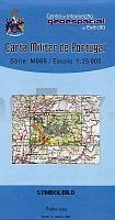
 | 434 - Topographische Landkarte Portugal 1:25.000 Carta Militar de Portugal - Série M888 Instituto Geográfico do Exército (IGeoE) - Portugal |
 | 0303 VERÃN Topographische Landkarte 1:50.000 Spanien (Grundlage MTN50) Instituto Geográfico Nacional - CNIG Spanien - ProjektNord |
 | 2514-II Hillerød - mit Wanderwegen und Fahrradrouten Topographische Fahrradkarte und Wanderkarte Dänemark 1:50.000 - Kort & Matrikelstyrelsen ProjektNord 2514-II Hillerød - Topografisk Cykel- og Vandrekort Danmark |
 | Kebnekaise 1:20.000/1:50.000 - Wanderführer und Gebirgswanderkarte 1:20.000/1:50.000 - Calazo Förlag Schweden Kebnekaise - vandringsguide och högalpin karta |