
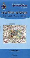
| << Portugal: Amtliche topografische Landkarten des Instituto Geográfico do Exército (IGeoE) 1:25.000 (Serie M888) |
||
|
||


Zuletzt angesehene Artikel:
 | 481 - Topographische Landkarte Portugal 1:25.000 Carta Militar de Portugal - Série M888 Instituto Geográfico do Exército (IGeoE) - Portugal |
 | 0097-2 CALDE Topographische Landkarte 1:25.000 Spanien (Grundlage MTN25) Instituto Geográfico Nacional - CNIG Spanien - ProjektNord |
 | 0139-2 EULATE Topographische Landkarte 1:25.000 Spanien (Grundlage MTN25) Instituto Geográfico Nacional - CNIG Spanien - ProjektNord |
 | 0455 ARÉVALO Topographische Landkarte 1:50.000 Spanien (Grundlage MTN50) Instituto Geográfico Nacional - CNIG Spanien - ProjektNord |
 | 0043-2 CORME Topographische Landkarte 1:25.000 Spanien (Grundlage MTN25) Instituto Geográfico Nacional - CNIG Spanien - ProjektNord |
 | 36O GOEDEREEDE (Oost) Topographische Karte der Niederlande 1:50.000 Topografische Dienst (Plotausgabe) |
 | 0589-4 VILLEL Topographische Landkarte 1:25.000 Spanien (Grundlage MTN25) Instituto Geográfico Nacional - CNIG Spanien - ProjektNord |
 | 397 - Topographische Landkarte Portugal 1:25.000 Carta Militar de Portugal - Série M888 Instituto Geográfico do Exército (IGeoE) - Portugal |
 | 511-2 BRIHUEGA Amtliche topographische Landkarte 1:25.000 Spanien (M.T.N.) 511-2 Mapa Topográfico Nacional de Espana (MTN25) Instituto Geográfico Nacional - CNIG Spanien |
 | 0369-3 ZAMORA NORTE Topographische Landkarte 1:25.000 Spanien (Grundlage MTN25) Instituto Geográfico Nacional - CNIG Spanien - ProjektNord |
 | 0189-2 QUIROGA Topographische Landkarte 1:25.000 Spanien (Grundlage MTN25) Instituto Geográfico Nacional - CNIG Spanien - ProjektNord |
 | 0684-1 NAVAHERMOSA Topographische Landkarte 1:25.000 Spanien (Grundlage MTN25) Instituto Geográfico Nacional - CNIG Spanien - ProjektNord |
 | 0072-1 PARGA Topographische Landkarte 1:25.000 Spanien (Grundlage MTN25) Instituto Geográfico Nacional - CNIG Spanien - ProjektNord |
 | Münchner Winterwanderungen (Nr. 575) Die 50 schönsten Touren südlich von München. Mit Tourenkarte zum Mitnehmen. GPX-Daten zum Download - von Siegfried Garnweidner - KOMPASS-Karten |
 | 301-2 MUÍÑOS Amtliche topographische Landkarte 1:25.000 Spanien (M.T.N.) 301-2 Mapa Topográfico Nacional de Espana (MTN25) Instituto Geográfico Nacional - CNIG Spanien |
 | 1017-2 EL ABALARIO Amtliche topographische Landkarte 1:25.000 Spanien (M.T.N.) 1017-2 Mapa Topográfico Nacional de Espana (MTN25) Instituto Geográfico Nacional - CNIG Spanien |
 | Rostow am Don 1:20.000 / Rostower Oblast 1:750.000 Stadtplan - Russland / Administrative Karte Ростовская область - Ростов на Дону DMB Kartografičeskoe izdatel´stvo |
 | 0071-3 SOBRADO Topographische Landkarte 1:25.000 Spanien (Grundlage MTN25) Instituto Geográfico Nacional - CNIG Spanien - ProjektNord |
 | 0526-2 MORASVERDES Topographische Landkarte 1:25.000 Spanien (Grundlage MTN25) Instituto Geográfico Nacional - CNIG Spanien - ProjektNord |
 | 0786-2 LA SOLANA Topographische Landkarte 1:25.000 Spanien (Grundlage MTN25) Instituto Geográfico Nacional - CNIG Spanien - ProjektNord |